70 years since the first photograph of the Earth from space
- Photographic equipment,
- Cosmonautics
The first photograph of the Earth from space was taken on film on October 24, 1946, from a V-2 ballistic missile.
On October 24, 1946, long before the Soviet Sputnik 1 officially ushered in the space age, a small search party of American scientists and soldiers gathered in the New Mexico desert. They were tasked with finding the crash site of a V-2 rocket and a cassette with 35mm film.
People were preparing to see something incredible for the first time in their history: what the Earth looks like from space.
On that day, a V-2 ballistic missile was launched from the White Sands Missile Range in New Mexico, USA. Unlike Wernher von Braun's previous rocket launches, the V-2 was now launched vertically.
A movie camera loaded with 35mm film took one frame every 1.5 seconds. The rocket rose to a height of about 105 kilometers and then fell down, crashing into the ground at a speed of 150 meters per second. The camera was completely broken, but the film itself in the steel cassette remained intact.
19-year-old US Army private Fred Rulli was one of the members of the search party sent on October 24, 1946. The military members of the expedition were not particularly impressed by the find. But something incredible happened to the scientists. When they found the steel cassette intact, they were overcome with utter delight: “They jumped like children,” recalls Rulli. Complete madness began when the film was delivered to the launch site, developed and the photographs were shown on the screen for the first time: “The scientists simply went crazy,” stated a private.
Until then, a record photograph earth's surface, taken from the highest altitude, remained a photograph from the American military helium balloon Explorer II, which rose into the air at 22,066 m in 1935. High enough to record the curvature of the globe (for the first time in the history of photography, the curvature of the horizon was captured on August 31, 1933 by aeronaut Alexander Dalya).
The camera on the V-2 rocket broke the record more than five times. People saw how our bright planet looks against the backdrop of the darkness of space.
"The photographs show for the first time what our Earth looks like to aliens arriving in spacecraft," Clyde Holliday, a rocket camera designer, said in a commentary for National Geographic. This magazine published an article about unique photography in 1950, when film frames were glued together into a single whole.

The result of a montage of footage taken during the launch of the V-2 on October 24, 1946
It was an amazing event.

Engineer Wernher von Braun (with a handkerchief in his jacket pocket)
The launch on October 24, 1946 was one of many experiments in the V-2 research program conducted by a group of engineers led by Wernher von Braun who were brought to work in the United States after the war as part of Operation Paperclip. For them, the US Joint Intelligence Objectives Agency (JIOA) created fictitious biographies and removed references to NSDAP membership and ties to the Nazi regime from public records. The general public learned about this secret operation by accident in December 1946, when chief design engineer Walter Riedel became the subject of a published article, “German Scientist Claims American Food Is Tasteless and Chicken Like Rubber.”
From 1946 to 1950, thanks to the V-2 launches, the Americans took more than 1,000 photographs of the Earth from altitudes of up to 160 km.
The famous German engineer Wernher von Braun began working on a liquid fuel rocket in 1930. A key influence on him was Professor Hermann Oberth, who is called one of the six founders of modern rocketry and cosmonautics, along with Konstantin Tsiolkovsky, Yuri Kondratyuk (and at the beginning of the twentieth century, Kondratyuk calculated the optimal flight trajectory to the Moon, which NASA later used in lunar program"Apollo"), Friedrich Zander, Robert Hainault-Peltrie and Robert Goddard.

Wernher von Braun later recalled his mentor: “Hermann Oberth was the first who, having thought about the possibility of creating spaceships, picked up a slide rule and presented mathematically based ideas and designs... Personally, I see in him not only guiding star my life, but also owes him my first contacts with theoretical and practical issues of rocketry and space flight.”
After the launch of the first satellites, photographing the Earth became one of the main tasks of government and then private programs. The Earth was filmed not only from satellites, but also from other spacecraft. For example, the American manned spacecraft Gemini 11, launched on September 12, 1966, took a picture from an altitude of 1368 km.

Photo from Gemini 11
Three years later, in July 1969, the crew of Apollo 11 took the famous photograph of the Earth above the lunar horizon. The image was taken from lunar orbit at a distance of about 400,000 km from Earth.

Photo from Apollo 11
Another scale of the Earth is shown in a photograph taken by the crew of Apollo 15 on July 26, 1971.

Photo from Apollo 15
With each passing decade, our spacecraft moved further and further into space, exploring the vastness of the solar system. On November 3, 1973, NASA launched Mariner 10, the first successful launch in the Mariner series. She became the first to visit Mercury on March 29, 1974. On the way to Mercury, the device took a photograph of the Earth and the Moon from a distance of 2.57 million km, photographing them together for the first time.
Perhaps the most remarkable photograph of the Earth was taken by the Voyager 1 probe on June 6, 1990, ten years after the start of its journey.

Photo of Earth from Voyager 1 (distance 6.05 billion km)
This photo went down in history as
1. “Blue Marble” - a famous photograph of the Earth, in which it is visible in its entirety. The photo was taken on December 7, 1972, when Apollo 17 left Earth orbit and headed towards the Moon. The sun was on the opposite side, and the crew was able to take this magnificent photo of the blue planet. The first complete photograph of the Earth.
2. The first photograph of the Earth from the Moon
In this photograph taken by spacecraft"Lunar-Orbiter 1" August 23, 1966, view of the Earth from the Moon. From a distance of about 380,000 km, we can see the surface of the Earth from Istanbul to Cape Town. In the areas to the west it is night.
3. The first color photograph of the rising Earth
When the program was launched in 1968"Apollo 8", her task was to make high resolution photographs of the lunar surface. But after finishing the photo shoot on the far side of the Moon, the spacecraft crew took this now famous photo. Dubbed "Earthrise," this shot of the Earth rising above the lunar horizon reminds people of the fragility of their home.
4. The first photograph of Earth from Mars
This is the first image of Earth from Mars, taken on May 8, 2003 by the camera of the Mars Global Surveyor spacecraft. From a distance of 139 million kilometers, the Earth looks like an illuminated slice: only the western hemisphere is visible. From afar, the scale of the world in which we live is better understood.
5. The first panoramic photograph from the surface of Mars
Soon after the Viking 1 spacecraft landed on Mars on July 20, 1976, its camera 2 took this first image from the Martian surface. The panoramic (300-degree) photograph shows the Cris Planitia region, a low plain in the northern hemisphere of Mars. The camera's field of view included parts of the landing apparatus and stones ranging in size from 10 to 20 centimeters in diameter.
6. The first photograph of the Martian surface
July 20, 1976 Viking 1 spacecraft took the first ever photograph of the Martian surface. One of the spacecraft's three legs is visible, covered in dust on the rock-strewn surface of Mars. Cameras mounted at various locations on Viking 1 helped scientists determine distances on the red planet's remarkably Earth-like surface.
7. The first color photograph from Venus
Despite the temperature of 482 degrees and atmospheric pressure 92 times higher than Earth's, on March 1, 1982, the Soviet spacecraft Venera 13 was able to take the first color photographs of the desert surface of Venus. In addition to the surface, the photograph shows zigzag-shaped parts of the descent module. The 170-degree panoramic camera was equipped with blue, green and red filters.
8. First photo from Titan
As can be seen in this composition, the surface Saturn's moon is an almost flat plain strewn with rocks the size of oranges. For comparison, here is a photo from the surface of the Moon. On January 14, 2005, the Cassini-Huygens mission (a joint US-ESA project) took 1,100 images during its landing on Titan.
9. The first photo of an exoplanet
In this image taken by the Southern European Observatory, the first known exoplanet (a planet outside the solar system) was captured. The red sphere at the bottom of the picture is a young planet, similar in physical properties to Jupiter. It orbits a brown dwarf - a dim, dying star with 42 times the mass of the Sun. This is an infrared camera image from a distance of approximately 230 light years.
10. First photograph of the Sun
Using something new for its time daguerreotype technology, on April 2, 1845, French scientists Louis Fizeau and Leon Foucault took the first successful photograph of the Sun. The original photo (at 1/60 shutter speed) was 12 centimeters in diameter and showed several sunspots. They are also visible in this reproduction.
11. A snapshot of the deepest space
800x exposure per 400 telescope rotations Hubble's orbit (from September 2003 to January 2004) produced this galaxy-filled image of deep space. Nearly 10,000 galaxies are visible in the image taken by the advanced camera for surveys as part of the Hubble Ultra-Deep Field program. Scientists say it's like looking at the sky for a long time through a 2.4-meter straw. So you get a piece of deep space.
12. Imprint on the Moon
Symbol of the giant step of all humanity- this small footprint of astronaut Edwin Aldrin on the surface of the Moon. The astronaut himself took this photo during NASA's Apollo 11 mission in 1969.
13. The first photographs from the surface of another planet
From June to October 1975, the Soviet space probe Venera 9 photographed Venus. It became the first spacecraft to enter orbit around another planet and land on its surface. Venera 9 consisted of a descent vehicle and orbiters: they separated in orbit. The 2,300-kilogram orbiter maintained communications and photographed the planet in ultraviolet light. And the descent capsule entered the planet’s atmosphere and sank to the surface with the help of several parachutes. A special panoramic photometer on board the probe took these 180-degree panoramic photographs of the surface of Venus.
1. In the photo - the mouth of the Betsibuka River in the northwestern part of the island of Madagascar. The photo was taken on March 8, 2005 by a member of the ISS-10 crew who worked on the ISS from October 16, 2004 to April 24, 2005.
2. The picture shows Hurricane Dean- the strongest tropical cyclone of the Atlantic hurricane season. Photo taken on August 18, 2007 by crew members on the space shuttle Endeavor.

3. October 5−13, 1984 - view of the Great Himalayas from the southwest. The photography covers the territories of India, Pakistan and China. The photo was taken during the 6th flight of the Challenger shuttle by one of the crew members.

4. Great lakes, located in North America. Lake Ontario is in the foreground, and the city of Detroit is in the center of the image. The photo was taken during the 19th space flight of Discovery in September 1994.

5. Cleveland Volcano Eruption on Chuginadak Island, North America. The photo was taken on May 23, 2006 by members of the thirteenth long-term crew of the International Space Station ISS-13.

6. Flying over Madagascar. This photo is the most recent in our collection: it was taken by cosmonaut Ricky Arnold, who on March 21 of this year launched as flight engineer 2 of the Soyuz MS-08 spacecraft together with Oleg Artemyev and Andrew Feistel. Two days later, the ship docked with the Russian segment of the ISS.

7. And this one is famous The shot was taken from a distance of 29,000 kilometers back in 1972 by the crew of the Apollo 17 mission. The image is called Blue Marble and shows the Earth fully illuminated by the Sun.

(Total 29 photos)

1. Go Discovery! On October 23, 2007 at 11:40 am, I went into space for the first time on the Discovery shuttle. He is wonderful... it's a pity that this is his last flight. I'm looking forward to boarding the ship when it arrives at the station in November.

2. Earthly radiance. The space station is in the blue terrestrial glow that appears when the rising sun pierces our planet's thin atmosphere, bathing the station in blue light. I will never forget this place... a view like this makes my soul sing and my heart wants to fly.

3. NASA astronaut Douglas H. Wheelock.

4. Juan de Nova Island in the Mozambique Channel between Madagascar and Africa. The amazing colors of these places can compete with the views of the Caribbean Sea.

5. Northern lights in the distance in one of beautiful nights over Europe. The Strait of Dover is clearly visible in the photo, as is Paris, the city of lights. Light fog over western England, particularly London. How incredible it is to see the lights of cities and towns against the backdrop of deep space. I will miss this view of our wonderful world.

6. “Fly me to the Moon...let me dance among the Stars...” (Take me to the Moon, let's dance among the stars). I hope we never lose our sense of wonder. A passion for exploration and discovery is a great legacy to leave to your children. I hope someday we'll set our sails and set off on a journey. Someday this wonderful day will come...

7. Of all the places on our magnificent planet, few can compete in beauty and richness of colors with. This photo shows our ship “Progress-37” against the backdrop of the Bahamas. How beautiful our world is!

8. At a speed of 28,163 km/h (8 km per second)... we orbit the Earth, making one revolution every 90 minutes, and seeing sunsets and sunrises every 45 minutes. So half of our journey takes place in pitch darkness. To work, we simply need flashlights on our helmets. In this photo I am preparing the handle of one device... "M3 Ammonia Connector".

9. Every time I look out the window and see our beautiful planet, my soul sings! I see blue skies, white clouds and a bright blessed day.

10. Another spectacular sunset. In Earth's orbit, we see 16 such sunsets every day, and each of them is truly valuable. This beautiful thin blue line is what makes our planet stand out from so many others. It's cold in space, and the Earth is an island of life in the vast dark sea of space.

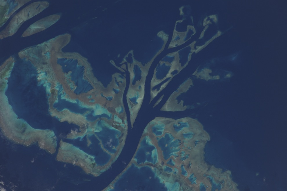
11. A beautiful atoll in the Pacific Ocean, photographed with a 400mm lens. Approximately 1930 km south of Honolulu.

12. Beautiful reflection sunlight in the eastern part Mediterranean Sea. There are no borders visible from space... From there you can only see breathtaking views, such as the view of this island of Cyprus.

13. Above the center Atlantic Ocean, before another amazing sunset. Below, the spirals of Hurricane Earl are visible in the rays of the setting sun. Interesting look at vital energy our sun. The sun's rays on the port side of the station and on Hurricane Earl... these two objects are collecting the last bits of energy before plunging into darkness.

14. A little further east we saw the sacred monolith of Uluru, better known as Ayers Rock. I've never had the opportunity to visit Australia, but one day I hope to stand next to this natural wonder.

15. Morning over the Andes in South America. I don’t know for sure the name of this peak, but I was simply amazed by its magic, the peaks reaching towards the sun and winds.

16. Over the Sahara Desert, approaching ancient lands and thousands of years of history. The Nile River flows through Egypt past the Pyramids of Giza in Cairo. Further, the Red Sea, the Sinai Peninsula, the Dead Sea, the Jordan River, as well as the island of Cyprus in the Mediterranean Sea and Greece on the horizon.

17. Night view of the Nile River, stretching like a snake through Egypt to the Mediterranean Sea, and Cairo, located in the river delta. What a contrast between the dark lifeless desert northern Africa and the Nile River, on the banks of which life is in full swing. The Mediterranean Sea can be seen in the distance in this photo taken on a beautiful autumn evening.

18. Our unmanned 'Progress 39P' is approaching the ISS for refueling. It's full of food, fuel, spare parts and everything we need for our station. Inside was a real gift - fresh fruits and vegetables. What a miracle after three months of tube feeding!


20. Soyuz 23C Olympus module docked on the nadir side. When our work here is finished, we will return home to Earth. I thought you might enjoy seeing this spectacle through the Dome. We fly over the snow-capped peaks of the Caucasus. Rising sun reflected from the Caspian Sea.
21. A flash of color, movement and life on our canvas amazing world. This is part of the Great Barrier Reef off the east coast of Australia, captured through a 1200mm lens. I think even the great impressionists would have been amazed by this natural painting.

22. All the beauty of Italy on a clear summer evening. You can see many beautiful islands decorating the coast - Capri, Sicily and Malta. Naples and Mount Vesuvius stand out along the coast.

23. At the southern end South America lies the pearl of Patagonia. The stunning beauty of the rugged mountains, massive glaciers, fjords and open sea combines in amazing harmony. I dreamed about this place. I wonder what it would be like to breathe the air there. Real magic!

24. The “dome” on the nadir side of the station gives a panoramic view of our beautiful planet. Fedor took this photo from the window of the Russian docking bay. In this photo I'm sitting in the canopy getting my camera ready for our evening flight over Hurricane Earl.

27. Clear starry night over the eastern Mediterranean Sea. Ancient lands from thousand years of history stretch from Athens to Cairo. Historical lands, fairytale cities and tempting islands... Athens - Crete - Rhodes - Izmir - Ankara - Cyprus - Damascus - Beirut - Haifa - Amman - Tel Aviv - Jerusalem - Cairo - they all turned into tiny lights on this cool November night. These places seem to emanate grace and tranquility.

28. At this time of year you can fully enjoy the beauty of the polar mesospheric clouds. Using our high light angle we were able to capture a thin layer of noctilucent clouds at sunset.

29. Shannon, me and Fedor in our Falcon suits in the MRM-1 module. We boarded the Olympus capsule to pressurize and check for leaks on our suits. All systems are running, the countdown has begun.
The birth of astrophotography is considered to be October 24, 1946. On this day, the American V-2 automatic rocket took the first photograph of the Earth from a suborbital altitude, about 105 km.
A series of photographs of the Earth were taken with a 35 mm film camera on black and white film; the quality of the image, by modern standards, was not the best.
The first astrophotography of the Earth from an altitude of 105 km.
In August 1959, the unmanned spacecraft Explorer 6 launched from Cape Canaveral, Florida, USA. It was equipped with photo elements that conveyed a picture of the earth's surface and atmosphere. It took almost 40 minutes to transmit the first photograph to Earth. The first orbital astrophotography captured a section of the earth's surface illuminated by the sun - it was Mexico. Explorer 6 ship rushed at a speed of over 32 thousand kilometers per hour, at an altitude of 28 thousand kilometers. This image is considered the first satellite photograph of the Earth from space.

The first satellite photograph of the Earth, from an altitude of about 28,000 km.
The first video of the Earth filmed in orbit
During a 25-hour space flight on August 6-7, 1961, Soviet cosmonaut German Stepanovich Titov made the first manual photography and video recording of the Earth from space.The filming was carried out with a Konvas film camera. In the book of memoirs “My Blue Planet” (1977) G.S. Titov wrote that the shooting was successful:
I tried to remember everything that I was taught in film training classes in order to film the view of our planet from the height of space flight, to film it so that people could look at their home - the planet from the outside. And the filmmaking practice really came in handy for me. Having prepared the Konvas camera, I decided to determine the exposure. On Earth, I often did this by eye, but here I didn’t take the risk, since an error in exposure could be costly. This is not filming a fishing scene. I took out a photo exposure meter, and... it turned out that I could easily put it back. The arrow of the sensitive element fell off under the influence of overloads and vibrations and, under conditions of weightlessness, occupied completely arbitrary positions. The first introductory note, as we say, has appeared. There was nothing left to do but estimate the illumination by eye and select the aperture. And then I remembered the saying “every cloud has a silver lining.” Some of the films I produced on Earth were, frankly speaking, not best quality. But practice “by eye” helped me out, and the film from space turned out to be successful.

A still from German Titov's photography of the Earth.
The Blue Marble “blue marble” is one of the most famous photos of planet earth, taken on December 7, 1972 by astronauts of the Apollo 17 spacecraft from a distance of about 29 thousand km. The photo shows the illuminated Earth while the Sun was behind the astronauts. This astrophotography has been used in many films to depict the Earth from space.

Far reaches of the solar system
Pale Blue Dot is an astrophotography of planet Earth that is impressive in its scale. This image, taken by the Voyager 1 probe from a distance of 5.9 billion km, shows the Earth against the backdrop of space. The very idea of taking a picture was proposed by astronomer and science popularizer Carl Sagan. Voyager had already completed its mission and was flying towards the boundaries of the heliosphere when, in February 1990, NASA commanded the device to turn around and take photographs of the planets of our star system. One of the images taken between February 14 and June 6, 1990, was an image of our planet, represented by a "pale blue dot" in a grainy image, is the most distant image of the Earth.

The small dot in the middle of the brownish stripe on the right is the Earth from a distance of 6 billion kilometers.
"Earthrise" - Earth photography, most likely taken by astronaut William Anders during his flyby of the Moon spaceship"Apollo 8". One of the most popular photographs of the Earth from space. The photo was taken on December 24, 1968.

"Earthrise" is one of the most famous photographs of our planet.
In February 2014, the Curiosity rover took pictures of the Earth from the surface of Mars. The picture was taken on a Martian night. Our planet was visible at this time, even without approaching. Also, the cameras of the device managed to take a picture of the Moon. It looked like a tiny bright speck next to the Earth. Let us remind you that these are not the first images from the surface of Mars. Previously, filming was carried out:
- NASA Spirit Mars rover 2004
- Mars Global Surveyor 2003
- Mars Reconnaissance Orbiter 2007

An image of the Earth from the surface of the “red” planet taken by the Curiosity rover
Likes( 1 ) Dislikes( 0 )