Extracurricular activity:
"Geographical monuments of Russia".
Voronezh 2015
Goals and objectives:
broadening your horizons and increasing interest in learning;
creating positive motivation in students’ acquisition of geographical knowledge;
the formation of a bright, memorable image of geographical monuments dedicated to geographical objects and travelers;
development of communication competencies;
fostering a sense of pride and respect for the historical and cultural heritage of one’s homeland.
Equipment: presentation, physical map Russia, interactive board.
Anticipatory task: Previously, several students chose the role of presenters and, together with the teacher, discussed which travelers, objects, and geographical monuments they would talk about. The material (text and presentation) was selected and prepared by the students themselves, the teacher played the role of a consultant.
DURING THE CLASSES
Teacher. Geography is one of the oldest sciences; its history goes back over 2000 years. During this time, hundreds of geographical monuments appeared on Earth. All of them are evidence of the discoveries and achievements of mankind. Carved from granite, cast from cast iron or bronze, monuments adorn the streets and squares of cities and remote outskirts of the globe. They are dedicated to great scientists and navigators, mark important natural sites, and are associated with geographical discoveries and transformations of nature. There are one and a half thousand geographical monuments in the world, most of them in the USA (about 300), Russia and Australia. We will get acquainted with the geographical monuments of Russia. Let's start with monuments that are interesting because they are installed in places notable for their geographical location.
Leading. 1910 Cape Dezhnev - the easternmost point on the Eurasian continent - in memory of the outstanding Russian explorer, a monument was erected: a massive twelve-meter cross. Attached to the base of the cross is a heavy copper plaque with an inscription stating that it was installed by the Shilka military transport team. At the end there is a short message: “Seafarers are invited to support this monument.”
A lighthouse rises next to the old cross. On the side of the lighthouse facing the ocean, there is a bronze bust of Dezhnev and a metal plaque with the inscription: “S.I. Dezhnev in 1648 was the first navigator to open the strait between Asia and America...”
Teacher. Guys, on the territory of our country there are two extreme points of the Eurasian continent, name another one and show it on the map. Who is it named after? Student response. The northernmost point, Cape Chelyuskin, is also marked with a memorial sign. Why learn “extreme points”? What is behind each territorial extreme of the country? As a rule, drama and heroism are worth it. Spilled or frozen blood. At our extreme points is the quintessence of Russia’s geographical destiny: between a rock and a hard place. The hammer of the expansive civilizations of the South and West and the anvil of the harsh nature of the North and Far East. In 1742, Semyon Ivanovich Chelyuskin first reached the extreme point of the continent, where he installed a “golden” log in the Arctic desert on the northernmost shore of the ocean as a beacon. The cape was named in honor of Semyon Chelyuskin, a polar explorer, in 1842, when the centenary of his expedition was celebrated. In the summer of 1992, the country’s northernmost monument to the discoverer of this northernmost point of the continent was opened at Cape Chelyuskin. The eight-meter monument, symbolizing the fin pillar-lighthouse that Chelyuskin erected here 250 years ago, seems to grow out of the stone guria and is crowned with a model of the dowel-sloop “Yakutsk” made of forged copper, on which the pioneers under St. Andrew’s flag made their way through the ice. Once or twice a year, supply ships drop anchor at Cape Chelyuskin. They are guided by modern navigation signs, and navigator Semyon Chelyuskin, noting the discovery of the northern cape of the mainland in his travel journal, wrote: “I set up a lighthouse - one log that I was carrying with me...”
Leading. Fifty memorial signs have been installed along the border between Europe and Asia. As you know, the conventional border between Europe and Asia is drawn along the eastern slope of the Ural Mountains. Previously, such a border was considered to be the watershed Ural ridge. Over the years, unique “border” markers, pillars, and obelisks were installed on this ridge. The oldest and most beautiful of them was built in 1868. Ural craftsmen cast an obelisk from cast iron in the form of a chapel 4 meters high. It is located 5 km from the village of Kedrovka, Sverdlovsk region. On its eastern side there is an inscription: “Asia, on the western side – Europe.” Most famous monument located on Mount Berezovaya near the city of Pervouralsk. It was installed on the Siberian Highway back in 1837. Its appearance has changed several times and now in place of a small pyramid stands a huge granite column. The newest obelisk on the border between Europe and Asia was erected in 1960, 35 km from Nizhny Tagil. The obelisk pillar is topped with a globe, around which models of artificial Earth satellites and a spacecraft “rotate” in orbit.
Urzhumka station (near Zlatoust). Railway crosses the border between two parts of the world: Europe and Asia. Passengers are awake, looking out the window and waiting for a high stone pyramid to appear, which is a border sign. On one side, “Europe” is clearly and large written on it, and on the other, “Asia”. This is a pass. Before him, the train was going uphill, and from here it will go down. In the Urals, over the years, many memorial signs have been installed in different places, but they all symbolize the same thing - the border between Europe and Asia.
Teacher. There is a tradition of marking the geographical centers of countries and continents with memorial signs. These points are largely arbitrary, since their position depends on the calculation method. This is clearly seen in the example of Europe, where there are six such points, but the geographical center of Asia is one, and it is located on the territory of our country. A unique obelisk was built in the capital of Tuva - the city of Kyzyl. The globe rests on a stone base, and on it is a high pyramidal pillar. The center of Asia is notable for the fact that the most abundant river in Russia, the Yenisei, begins here at the confluence of two rivers. Quite recently, a whole sculptural complex was created in Krasnoyarsk - the monument-fountain “Rivers of Siberia”. In the center of the composition is the Yenisei, strongly reminiscent of Poseidon, and around him are seven nymphs - symbols of the Angara, Bazaikha, Biryusa, Kachi, Mana, Lower Tunguska and Khatanga rivers.
Exercise . Show these rivers on the map, determine which of them are tributaries of the Yenisei.
Leading. The main attraction of the Evenki Lake Vivi in the Krasnoyarsk Territory is the memorial sign “Golden Flower of Russia”, which is installed in the geographical center of Russia. Soon after the collapse of the USSR, the coordinates of the Center of Russia (94 degrees 15 minutes E, 66 degrees 25 minutes N) were calculated by academician Pyotr Bakut, for which an original formula was created. After checking Federal service geodesy and cartography beyond Lake Vivi, the status of the Center of Russia was officially approved. The monument, about 7 meters high, was erected on August 21, 1992 by the scientific and sports expedition named after I.D. Papanin, and the grand opening took place on August 27. An 8-meter Orthodox cross in memory of the 600th anniversary of the death of Sergius of Radonezh. A wooden chapel of St. Sergius of Radonezh was built on the shore of the lake.
Teacher. Show the geographic center of Russia on the map.
There are many memorial signs on the borders of states. It is not difficult to guess the semantic meaning of such monuments as “Prayer for the return of the Northern Territories to Hokkaido,” or “Friendship of Peoples” on the border of Russia, Ukraine and Belarus.
Teacher. Many conventional lines on the surface of the Earth are marked with memorial signs. There are especially many of them located along the Arctic Circle. Remember what parallels, meridians, and the Arctic Circle are? Student response.
Leading. Monuments « Arctic Circle"installed in Chukotka, the Komi Republic, Yakutia, Karelia, the Murmansk region, on the Urengoy-Yamburg highway, in Salekhard. Salekhard – the only city on earth, located at the latitude of the Arctic Circle. One of the main attractions of the city is a memorial sign, a symbol of the geographical uniqueness of the city, located directly on the Arctic Circle. Two pointed pyramids 20 and 22 meters high symbolize the chums - the national dwellings of the indigenous people. The arc in the middle is the Arctic Circle. The stele is made of durable colored glass. In the evening, installed lamps illuminate the stele from the inside, giving it the colors of the northern lights.
Teacher. There are memorial signs on other parallels - in Krasnodar (45th parallel), in the city of Totma, Vologda Region - a memorial sign "60th parallel", Vorkuta - a sign - 67th parallel, which stands at a fork in the road, symbolizing that the territory of the city of Vorkuta extends from the north to the south between 66 and 68 degrees north latitude.
Leading. The geographical parallel of 45 degrees north latitude is the symbol of the city of Krasnodar. The memorial sign is quite modest and consists of a painted wooden arrow on an iron support. It is made in honor of the most favorable parallel for life on our planet. Krasnodar, where this monument was unveiled, is located exactly in the middle between the North Pole and the equator, at the 45th parallel. This parallel is also called the “golden line” or “life line”. It is believed that at this latitude the conditions for human life are most favorable. This parallel is called the “Golden Mean of Planet Earth”. It is at this latitude that the climate is most favorable - long daylight hours and sufficient amounts of solar heat.
Teacher. On the territory of our country, some meridians are marked with memorial signs. Pulkovsky. Until the beginning of the 20th century, the meridian was used as the prime meridian for measuring geographic longitude on maps Russian Empire. The meridian passes through the center of the Round Hall of the main building of the Pulkovo Observatory. The “180 Meridian” monument is located on the north-eastern coast of Chukotka, 23 km west of Cape Schmidt.
Leading. On September 22, 2004, in the valley of the Tadlean River, a red pillar was installed, at the base of which there was a barrel with the inscription: “The point of intersection of the Arctic Circle line and the 180th meridian.” The uniqueness is that this is the only point located on land; all the others (crossing the 180 meridians along the equator and the tropics) are located in the sea. In addition, this is where the geographic date line passes. Since the 180th meridian is a continuation of Greenwich, this is where the border between the eastern and western hemispheres passes. Simply put, take a step to the side and you are back exactly one day.
Teacher. Geographical monuments are installed not only on the territory of the country, but also beyond its borders, not only on land, but also in the ocean. At the North Pole at a depth of 4261 m in August 2007, a Russian flag made of titanium was installed. A unique monument is the Kronstadt water pole, which marks the water level of the World Ocean and all absolute heights on land. Russian monuments can be seen in Antarctica. Station "Vostok" - the Pole of Cold of the Earth. There, on a pedestal made of barrels, stands an old all-terrain vehicle. Pole of Relative Inaccessibility. At the pole of inaccessibility there is a bust of Lenin. It was delivered by a sleigh-caterpillar train by the third Soviet Antarctic expedition, which was the first in the world to reach the Pole of Inaccessibility on December 14, 1958.
Leading. The cold pole of the Northern Hemisphere is located in Russia, in eastern Yakutia, in the upper reaches of the Indigirka River. In Verkhoyansk, the absolute minimum temperature was minus 680; in Oymyakon, a temperature of 71.20 was recorded. The Pole of Cold is marked with a memorial sign. On the scale of the symbolic thermometer, a division of –720 is marked on the board - a portrait of S.V. Obruchev and an explanatory text about his discovery of the pole of cold.
An interesting monument “The Navel of the Earth” was erected in Kungur. It is made of granite in the shape of a pulusphere resting on a sloping pedestal. Around the “Navel of the Earth,” according to all the rules of geography, there is a wind rose, precisely oriented to the four parts of the world. On the axes of the hemisphere it is written how many kilometers separate Kungur from the world capitals. Scientists believe that the appearance of the “Navel” on our land is geographically justified. Kungur is the first city in Europe if you move from Siberia. Here four rivers, breaking the laws of nature, flow from the four cardinal directions. The monument was installed in historical center city on the embankment of the Sylva River in 2007.
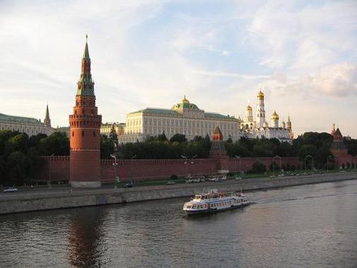
Teacher. Geographical monuments are very diverse. These can be memorial plaques and statues, slender obelisks and arches, they can be seen everywhere. They mark the sources of many rivers; they are installed on passes and on mountain tops. Most of the monuments were erected in honor of outstanding scientists and navigators, Russian explorers and explorers. In Russia, most of the geographical monuments are installed in large port cities - centers of navigation and geographical research. And first of all, this is, of course, St. Petersburg, where 14 such monuments were erected, including Nikolai Przhevalsky and Thaddeus Bellingshausen, Vasily Dokuchaev and Pyotr Semenov-Tyan-Shansky. The most famous of them is the monument to Ivan Kruzenshtern, the leader of the first Russian round-the-world expedition. According to tradition, cadets of the Marine Corps annually dress his statue in a huge vest after graduation. The monument was erected in 1873. Three-meter bronze sculpture, on a granite pedestal (2.6 m), cartouche, text board, cast iron fence. Inscriptions: on the pedestal on the front side in a cartouche with the image of the coat of arms: “Living in hope”; Below is the text of the board in cast characters: “To the first Russian (navigator around the world) Admiral I.F. Kruzenshtern.”
Teacher. Guys, tell me who took part in the 1st Russian round-the-world expedition of I.F. Kruzenshtern and commanded the sloop “Neva”? Student answers. Yu.F. Lisyansky. The monument to Yu.F. Lisyansky was erected in his homeland in the city of Nizhyn.
Participant in the first Russian circumnavigation of the world in 1803-1806. under the command of I.F. Kruzenshtern was another of the remarkable navigators, the leader of the expedition that discovered Antarctica in 1820. Guys, say his name. Student answers.
Leading. F.F. Bellingshausen is a brave navigator. In 1803, he was appointed to the first round-the-world expedition as a junior officer on the frigate Nadezhda. During this journey, Bellingshausen was engaged in drawing up maps. In 1819-1821 leader of the first Antarctic expedition that discovered Antarctica in 1820. The monument to the brave navigator was opened in September 1870 in Kronstadt. The figure of Bellingshausen is presented in full height. He is in full admiral's uniform from the forties of the 19th century. With one hand he rests on a globe supported on three dolphins, which symbolizes the courage, perseverance and combat skill of his fellow soldiers, without whom he could not have made his great discoveries. In the admiral's other hand is a spyglass. It was through its eyepiece that he saw Antarctica, a country of mountains and ice, and was able, for the first time in the history of science, to tell all of humanity about it. As for the globe, there is some symbolism here too. If you climb higher and take a good look, it turns out that under the admiral’s hand is not the North Pole, but the South! Upside down globe! But this is probably correct: after all, F.F. Bellingshausen did not go to the Arctic, but to Antarctica. Moreover, scientists have recently discovered another secret of our blue planet: in a few million years, our Earth should turn over and, as a result of this, its poles will change places. Then the theme of the monument to our polar navigator will sound in full accordance with reality.
Teacher. M.P. Lazarev. In 1813-1816 being the commander of the ship "Suvorov", he circumnavigated the world, during which he discovered an atoll, called "Suvorov". In 1819-1821, commanding the sloop Mirny, he participated in the expedition of F.F. Bellingshausen, who discovered Antarctica. Made three circumnavigations of the world. The monument to M. Lazarev was erected in 1867 in Sevastopol, later in Nikolaev, at the Lazarevskoye station.
Leading. In 1892, a monument to Nikolai Mikhailovich Przhevalsky, the famous Russian traveler and explorer of Central Asia, was inaugurated in St. Petersburg. The routes of his expeditions ran through the mountains of Altai, Tibet, Kun-Lun, and crossed the waterless deserts of Tsaidam and Taklamakan. Monuments to N.M. Przhevalsky were erected in his native Smolensk region, on the shores of Lake Issyk-Kul, where the traveler is buried.
Teacher. Guys, which other famous travelers and scientists have monuments on our Smolensk land? (Answers from students. V.V. Dokuchaev. P.K. Kozlov.)
Leading. A few years ago, another monument appeared in our Smolensk region - the largest globe in Europe (second in the world, after the one located in New York). The globe has a height of 12 meters, a diameter of 10.5 meters and a weight of 11.5 tons, located on six pillars a meter above the ground. The design of the globe is a metal ball (a former gas tank, which was used to accumulate nitrogen; its useful life has expired and the company’s managers decided to make a globe out of it instead of scrapping it). The ball was painted by professional Smolensk artists who had undergone special training to work at heights, under the supervision of the project manager, designer Mikhail Shvedov, who planned to make it geographical map peace, as a kind of symbol of Earth protection. The globe itself is located near the Dorogobuzh OJSC plant, 5 km from the Verkhnedneprovsky urban-type settlement. The plant is indicated on the surface of the globe by a small illuminated dot.
Teacher. Many monuments are dedicated to Russian explorers - brave discoverers of Siberian lands. They went to “distant, unknown lands,” into the unknown, where unknown peoples lived, not always hospitable. They walked through distances and wars, terrible dangers, under thunderstorms and blizzards, under the scorching sun, along dangerous roads and without roads at all... The work of the explorer was so hard that travelers were allowed not to keep fasts, and in all the churches of Russia a prayer is performed daily “ about wandering and traveling." With labor and feat they expanded the boundaries of our Fatherland and the limits of our knowledge about other lands and peoples, they accepted the labors and torments of wanderings, sacrificing their lives for the sake of serving Russia, their names entered the history of our State and constitute its imperishable Glory. Monuments to them were erected in Tobolsk and Murmansk, Totma and Noyabrsk, Nizhnevartovsk and Salekhard and other places. In Khanty-Mansiysk there are three of them - “Discoverers of the Ugra Land”, “Pioneers of the Ugra Land” and “Transformers of the Ugra Land”.
Emperor Nicholas 1 personally ordered the construction of a monument to Ermak in Tobolsk. Palm branches are carved on the edges of the obelisk, and inscriptions are placed on the pedestal on both sides: “To the conqueror of Siberia Ermak” and “Erected in 1939.” On the other sides of the wreaths there are inscriptions: “1581” (the beginning of the campaign in Siberia) and “1584” (the year of Ermak’s death).
Leading. There are monuments to Russian geographers and navigators outside Russia - Evfimy Putyatin and Vasily Golovnin in Japan, Nikolai Rezanov and Alexander Baranov in Alaska, Nikolai Miklouho-Maclay in New Guinea. And, on the contrary, in Russia there are monuments to foreign navigators, for example, Jean-François de La Perouse in the Far East, Fridtjof Nansen in Moscow, Roald Amundsen in St. Petersburg.
Teacher. Monuments to geologists have been erected in many cities: on the Kola Peninsula - to Alexander Fersman, in Magadan - to Yuri Bilibin, on Aldan - to gold miners, in Tomsk, Salekhard and Bashkiria - to oil workers. A monument to the discoverers of Bashkir oil was opened in the city of Ishimbay. The monument is a massive stone. A 12-meter granite figure of a geologist - a hero, tearing apart a rock, wresting oil from the Ural stone with effort. Most interesting monument installed near the city of Mirny. Sculptural composition“Discoverers of Yakut Diamonds” includes three figures - a musher riding a deer and two geologists enthusiastically examining rock samples.
Leading. Yuri Aleksandrovich Bilibin is a pioneer, discoverer of the “Golden Kolyma”. In 1968, a monument to the outstanding geologist was unveiled in the city of Bilibino, two crossed geological hammers on the pedestal of the monument - an emblem dear to every geologist; a bust of Yu.A. Bilibin was erected in the city of Magadan in 2003.
Teacher. In 2002, a monument to Fridtjof Nansen, a great polar explorer, an outstanding scientist whose achievements and discoveries greatly changed the world, and also a man who saved millions of Volga region residents from starvation, was unveiled in Moscow. He organized charitable assistance behind own funds, thanks to Nansen's efforts, about 7 million people were saved. The monument is a full-length sculpture of the famous Norwegian and a little girl leaning against him, biting a piece of bread.
Leading. Four years ago in Gelendzhik before maritime museum Monuments to the great navigators were erected - Ferdinand Magellan, Vasco da Gama and Christopher Columbus. The first to greet visitors is Christopher Columbus. His expedition on October 12, 1492 discovered America, marking the beginning of exploration of the New World.
Teacher. At the end of our journey we will spend a little quiz.
1. Who was the first Russian traveler to visit India, where a monument was erected to him?
2. Name the traveler who was the first to discover the strait separating Alaska from Chukotka in 1648, 80 years earlier than Vitus Bering. The extreme point of Eurasia bears his name, where are monuments to him erected?
3. Which explorer was the first to overcome the Urals? Where is his monument erected?
4. Name the brothers, polar explorers, after whom the sea of the Arctic Ocean is named. Where is the memorial sign installed for them?
5. Which of the travelers received the name “Russian Columbus”? A bay in the Sea of Okhotsk is named after him; he was the first to create Russian settlements in America.
6. Who is this explorer who traveled the entire Amur on ships, the city was named after him and a monument was erected there, it was called the railway. station on the Trans-Siberian Railway?
7. Who led the first Russian round-the-world expedition?
8. Who discovered Antarctica? Which of them has a monument erected in St. Petersburg?
Teacher. Let's finish our journey in Moscow at the Yaroslavl station, there is a memorial sign on which there are two numbers - 0 and 9298. The sign is an exact copy of a cast-iron milepost from the beginning of the century and indicates the zero kilometer of the world's longest railway line - the Trans-Siberian Railway, and the number on it - this is its length in kilometers.
Tsarikaev David
Geography is one of the oldest sciences; its history goes back over 2000 years. During this time, hundreds of geographical monuments appeared on Earth. All of them are evidence of the discoveries and achievements of mankind. Carved from granite, cast from cast iron or bronze, monuments adorn the streets and squares of cities and remote outskirts of the globe. They are dedicated to great scientists and navigators, mark important natural sites, and are associated with geographical discoveries and transformations of nature. There are one and a half thousand geographical monuments in the world, most of them in the USA (about 300), Russia and Australia.
Having studied the literature on this issue, I was faced with the question: do my classmates and residents of my city know about geographical monuments? To answer this question, I conducted a sociological survey in which people of various professions and different ages participated. The survey revealed that only 23% of respondents know about the existence of such monuments. This is how the desire arose to tell about the geographical monuments of Russia.
During our research we will get acquainted with geographical monuments
Download:
Preview:
III Open Lomonosov Readings
MBOU secondary school No. 36
Section: “Geography. Geology"
Topic: “Geographical monuments of Russia”
Completed:
Student 8 "B" class
School No. 36
Tsarikaev David Zaurbekovich
Supervisor
Geography teacher
Artamonova V.V.
Vladikavkaz 2013
Introduction
- Memorial sign "Arctic Circle"
- Parallels
- Meridians
- Geographical monument “point of intersection of the SPK line and the 180th meridian”
- Geographical monuments along the Europe–Asia border
- The largest monument in Europe - Asia
- The oldest obelisk Europe - Asia
- The northernmost obelisk Europe - Asia
- The most cosmic monument in Europe - Asia
- The most beautiful obelisk Europe - Asia
- The most geographical monument of Europe - Asia
- The most religious monument in Europe - Asia
- The most visited monument in Europe - Asia
- The easternmost obelisk Europe Asia.
- Geographical monuments of the centers of countries and continents
3.1 Geographical monument “Center of Asia”.
3.3. Monument "Navel of the Earth".
3.4. Pole of Cold – Oymyakon
Conclusion
Bibliography
Applications
Introduction
Geography is one of the oldest sciences; its history goes back over 2000 years. During this time, hundreds of geographical monuments appeared on Earth. All of them are evidence of the discoveries and achievements of mankind. Carved from granite, cast from cast iron or bronze, monuments adorn the streets and squares of cities and remote outskirts of the globe. They are dedicated to great scientists and navigators, mark important natural sites, and are associated with geographical discoveries and transformations of nature. There are one and a half thousand geographical monuments in the world, most of them in the USA (about 300), Russia and Australia.
Having studied the literature on this issue, I was faced with the question: do my classmates and residents of my city know about geographical monuments? To answer this question, I conducted a sociological survey in which people of various professions and different ages participated. The survey revealed that only 23% of respondents know about the existence of such monuments. This is how the desire arose to tell about the geographical monuments of Russia.
In the course of our research, we will get acquainted with the geographical monuments of Russia and determine their location. Let's start with monuments that are interesting because they are installed in places notable for their geographical location.
Subject of study– geographical distribution of Russian geographical monuments.
Goal of the work – analysis of patterns and dynamics of distribution of geographical monuments across the territory of the Russian Federation
Tasks:
1 . pick up and analyze the literature
2. study the history of the creation of geographical monuments.
3. determine the location and geographical coordinates of geographical monuments.
4. select illustrations of geographical monuments, prepare a presentation for the lesson.
Research methods.When carrying out the research, historical-geographical, cartographic, statistical, comparative-geographical methods were used.
- Geographical monuments of conventional lines on the surface of the Earth
A monument is a structure of architecture or sculpture in honor and memory of an event
or faces. The concept of a monument is very broad and includes many types of structures. Monuments are clearly located in space and tied to specific places, so they carry a geographical load. The monuments made up the complete picture " cultural geography» countries, marking places associated with geographical features.
Geographical monuments are very diverse. These can be memorial plaques and statues, slender obelisks and arches, they can be seen everywhere.
Many conventional lines on the surface of the Earth are marked with memorial signs. There are especially many of them located along the Arctic Circle.
1.1. Monument "Arctic Circle"
The Arctic Circle monuments were installed in Chukotka, the Komi Republic, Yakutia, Karelia, the Murmansk region, on the Urengoy-Yamburg highway, and in Salekhard. Salekhard is the only city on earth located at the latitude of the Arctic Circle. One of the main attractions of the city is a memorial sign, a symbol of the geographical uniqueness of the city, located directly on the Arctic Circle. Two pointed pyramids 20 and 22 meters high symbolize the chums - the national dwellings of the indigenous people. The arc in the middle is the Arctic Circle. The stele is made of durable colored glass. In the evening, installed lamps illuminate the stele from the inside, giving it the colors of the northern lights. Today I found 9 signs.
1.2. Parallels.
There are memorial signs on other parallels - in Krasnodar (45th parallel), in the city of Totma, Vologda Region - a memorial sign "60th parallel", Vorkuta - a sign - 67th parallel, which stands at a fork in the road, symbolizing that the territory of the city of Vorkuta extends from the north to the south between 66 and 68 degrees north latitude.
The geographical parallel of 45 degrees north latitude is the symbol of the city of Krasnodar. The memorial sign is quite modest and consists of a painted wooden arrow on an iron support. It is made in honor of the most favorable parallel for life on our planet. Krasnodar, where this monument was unveiled, is located exactly in the middle between the North Pole and the equator, at the 45th parallel. This parallel is also called the “golden line” or “life line”. It is believed that at this latitude the conditions for human life are most favorable. This parallel is called the “Golden Mean of Planet Earth”. It is at this latitude that the climate is most favorable - long daylight hours and sufficient amounts of solar heat.
1.3.Meridians
On the territory of our country, some meridians are marked with memorial signs, for example, Pulkovo. Until the beginning of the 20th century, the meridian was used as the prime meridian for measuring geographic longitude on maps of the Russian Empire. The meridian passes through the center of the Round Hall of the main building of the Pulkovo Observatory. The “180 Meridian” monument is located on the north-eastern coast of Chukotka, 23 km west of Cape Schmidt.
1.4.Geographical monument “Intersection point of the Arctic Circle line and the 180th meridian”
On September 22, 2004, in the valley of the Tadlean River, a red pillar was installed, at the base of which there was a barrel with the inscription: “The point of intersection of the Arctic Circle line and the 180th meridian.” The uniqueness is that this is the only point located on land; all the others (crossing the 180 meridians along the equator and the tropics) are located in the sea. In addition, this is where the geographic date line passes. Since the 180th meridian is a continuation of the Greenwich meridian, this is where the border between the eastern and western hemispheres passes. Simply put, take a step to the side and you... go back exactly one day.
- Geographical monuments along the border of Europe and Asia.
In the Urals there is a conditional border that runs between Europe and Asia. Many people want not only to see this line between parts of the world, but also to touch it with their hands. That is why it was decided to build a Europe-Asia monument in the Urals, which will symbolize this border. The problem is that specialists (historians, geographers, etc.) do not have consensus about where this line is located, and its length along the Ural ridge is more than 5 and a half thousand km. How can we determine the point at which to place the obelisk?
So these monuments are still being erected, and in the Urals tourists can tour up to 50 monuments from Europe to Asia.
2.1.The largest monument Europe - AsiaThe grand opening of the largest obelisk in Europe - Asia took place in 2008. It is located just two km from Pervouralsk, so getting there is no problem. It should be noted that the architectural ensemble around the monument occupies a beautiful large area, which looks very landscaped: cozy gazebos, well-groomed flower beds. It is especially beautiful here, of course, in the summer. The territory is protected. This monument is most often chosen by newlyweds for their wedding trip.
2.2.The oldest obelisk Europe - Asia
This monument is unique in its unusual story. It was first installed in early XIX century, in 1807, and in 1837 the emperor himself decided to come here. Accordingly, for his arrival, the wooden stele was replaced with a more luxurious one - marble, decorated with the royal coat of arms. Today, the area around the obelisk is always well-groomed and improved. There is even a special romantic bench for lovers and a beautiful metal tree on which newlyweds who come here hang locks as symbols of the indissolubility of marital ties.
2.3.The northernmost obelisk Europe - Asia
This monument, dedicated to the border of Europe and Asia, is located in a very picturesque place that every vacationer will enjoy - this is the shore of the Yugorsky Shar Strait. The places here are quite difficult to pass, so the obelisk was installed by employees of the polar station. The monument is a simple wooden pillar with the inscription “Europe – Asia” on it. It has been here since 1973. A special feature of this monument is the anchor with a chain, which is nailed to the pillar.
2.4.The most cosmic monument in Europe is Asia
It is not difficult to guess that the construction of the monument was timed to coincide with the first manned flight into space - in 1961. It is located on the Nizhny Tagil - Uralets highway. The monumental building is a square column that goes up 6 meters. At the tip of the obelisk you can see an image of the globe.
2.5.The most beautiful obelisk Europe - Asia
This monument captivates everyone who is lucky enough to see this masterpiece. Winged lions on a pedestal and double headed eagle at the peak of the obelisk they look solemn and truly majestic. The monument is located on the road between the cities of Kachkanar and Chusovoy. The opening took place in 2003, at the same time a line was drawn on the asphalt, which symbolized the border between Europe and Asia. The height of the monument is as much as 16 meters!
2.6.The most geographical monument of Europe is Asia
Not long ago, a monument appeared on the Novomoskovsky tract, which is located within the boundaries of Yekaterinburg. The project was designed by Konstantin Grunberg and installed in the summer of 2004. A massive marble pedestal, a spacious observation deck and a metal stele running upward leave an incredible feeling of solemnity. Why is this monument the most geographical? Everything is very simple: stones were laid here, brought from the most extreme points of two parts of the world - from Cape Roca and Cape Dezhnev.
2.7.The most religious monument in Europe - Asia
A grandiose square column of 15 meters is crowned with a huge ball made of stainless alloy. The project and installation were led by architect Naumkin in 1981. The monument is located near Orenburg. On the coat of arms of the Orenburg region there is a Greek-Russian cross and a crescent, indicating that the Orenburg region is located on the border of Europe and Asia and that Orthodox Russians and Muslim Bashkirs, Tatars, and Kazakhs live nearby.
2.8. The most visited monument in Europe is Asia.
Urzhumka station (near Zlatoust). The railway crosses the border between two parts of the world: Europe and Asia. Passengers are awake, looking out the window and waiting for a high stone pyramid to appear, which is a border sign. On one side, “Europe” is clearly and large written on it, and on the other, “Asia”. This is a pass. Before him, the train was going uphill, and from here it will go down.
2.9. The easternmost obelisk Europe Asia.
The obelisk near the village of Kurganovo is the easternmost obelisk of Europe Asia and the easternmost border of Europe. The obelisk is located on Polevskoye Highway, 2 km from the village of Kurganovo. The sign was installed in June 1986 in the year of the 250th anniversary of the scientific substantiation of the border between Europe and Asia by V. N. Tatishchev. The location for the obelisk was chosen jointly with members of the Yekaterinburg branch of the Russian Geographical Society.
In the Urals, over the years, many memorial signs have been installed in different places, but they all symbolize the same thing - the border between Europe and Asia.
III. Geographical monuments of the centers of countries and continents.
3.1. Geographical monument "Center of Asia".
There is a tradition of marking the geographical centers of countries and continents with memorial signs. These points are largely arbitrary, since their position depends on the calculation method. This is clearly seen in the example of Europe, where there are six such points, but the geographical center of Asia is one, and it is located on the territory of our country. A unique obelisk was built in the capital of Tuva - the city of Kyzyl. The globe rests on a stone base, and on it is a high pyramidal pillar. The center of Asia is notable for the fact that the most abundant river in Russia, the Yenisei, begins here at the confluence of two rivers. Quite recently, a whole sculptural complex was created in Krasnoyarsk - the monument-fountain “Rivers of Siberia”. In the center of the composition is the Yenisei, strongly reminiscent of Poseidon, and around him are seven nymphs - symbols of the Angara, Bazaikha, Biryusa, Kachi, Mana, Lower Tunguska and Khatanga rivers.
3.2. Geographical monument "Center of Russia".
The main attraction of the Evenki Lake Vivi in the Krasnoyarsk Territory is the memorial sign “Golden Flower of Russia”, which is installed in the geographical center of Russia. Soon after the collapse of the USSR, the coordinates of the Center of Russia (94 degrees 15 minutes E, 66 degrees 25 minutes N) were calculated by academician Pyotr Bakut, for which an original formula was created. After an inspection by the Federal Service of Geodesy and Cartography, the status of the Center of Russia was officially approved for Lake Vivi. The monument, about 7 meters high, was erected on August 21, 1992 by the scientific and sports expedition named after I.D. Papanin, and the grand opening took place on August 27. An 8-meter Orthodox cross was placed nearby in memory of the 600th anniversary of the death of Sergius of Radonezh. A wooden chapel of St. Sergius of Radonezh was built on the shore of the lake. A wooden chapel of St. Sergius of Radonezh was built on the shore of the lake. On September 9, 2006, its consecration took place.
3.3. Monument "Navel of the Earth".
An interesting monument “The Navel of the Earth” was erected in Kungur. It is made of granite in the shape of a pulusphere resting on a sloping pedestal. Around the “Navel of the Earth,” according to all the rules of geography, there is a wind rose, precisely oriented to the four parts of the world. On the axes of the hemisphere it is written how many kilometers separate Kungur from world capitals (Moscow, Paris, Tokyo, Beijing, etc.). Scientists believe that the appearance of the “Navel” on our land is geographically justified. Kungur is the first city in Europe if you move from Siberia. Here four rivers, breaking the laws of nature, flow from the four cardinal directions. The monument was erected in the historical center of the city on the embankment of the Sylva River in 2007.
3.4. Pole of cold – Oymyakon.
The cold pole of the Northern Hemisphere is located in Russia, in eastern Yakutia, in the upper reaches of the Indigirka River. In Verkhoyansk, the absolute minimum temperature was minus 680; in Oymyakon, a temperature of 71.20 was recorded. The Pole of Cold is marked with a memorial sign. On the scale of the symbolic thermometer, a division of –720 is marked on the board - a portrait of S.V. Obruchev and an explanatory text about his discovery of the pole of cold.
Conclusion.
We will get acquainted with the geographical monuments of Russia. All of them are evidence of the discoveries and achievements of mankind. Carved from granite, cast from cast iron or bronze, monuments adorn the streets and squares of cities and remote outskirts of the globe. Geographical monuments are very diverse. These can be memorial plaques and statues, slender obelisks and arches, they can be seen everywhere.
During our research, we got acquainted with the geographical monuments of Russia, determined their location and geographical coordinates, and collected photographs.
But it’s too early to end our journey.
During our research, we learned that the sources of many rivers are also marked with geographical monuments; they are installed on passes and on mountain tops. Most of the monuments were erected in honor of outstanding scientists and navigators, Russian explorers and explorers. In Russia, most of the geographical monuments are installed in large port cities - centers of navigation and geographical research. And it seems to us that our research needs to be continued.
Practical part Annex 1 .
- Memorial sign “Arctic Circle” near Usinsk (Komi River)
66 ̊ N; 57°E
- Memorial sign “Arctic Circle” on the Urengoy – Yamburg highway (Yamalo-Nenets Autonomous Okrug)
67 ̊ N; 74 ̊ east
- Arctic Circle sign in Salekhard
66 ̊ N ; 66 ̊ east
- Arctic Circle sign near the village of Umba (Murmansk region)
66 ̊ N ; 34 ̊ east
- Stele "Polar Circle" on the federal highway M - 18 (Poyakonda village)
66 ̊ N ; 34 ̊ east
- Geographical monument “Intersection point of the SEC and the 180th meridian”
68 ̊ N; 180 ̊ east
- Pulkovo meridian (St. Petersburg)
59 ̊ N ; 30 ̊ east
- Sign "45 meridian" Krasnodar
45 ̊ N ; 39 ̊ east
- Sign "67 parallel" Vorkuta
67 ̊ N ; 64 ̊ east
- Memorial sign “60 parallel” in the city of Totma, Vologda region
60 ̊ N ; 42 ̊ east
- Monument "Europe - Asia" 2 km. t of Pervouralsk
56 ̊ N ; 60 ̊ east
- Monument "Europe - Asia" Pervouralsk - the oldest
56 ̊ N ; 60 ̊ east
- Monument "Europe - Asia" on the Nizhny Tagil - Uralets highway
57 ̊ N ; 59 ̊ east
- Monument "Europe - Asia" between the towns of Kachkanar and Chusovoy
58 ̊ N ; 59 ̊ east
- Monument "Europe - Asia" Ekaterinburg
56 ̊ N ; 60 ̊ east
- Monument "Europe - Asia" Orenburg
51 ̊ N ; 55 ̊ east
- Monument "Europe - Asia" Urzhumka station
55 ̊ N ; 59 ̊ east
- Monument "Europe - Asia" in the village of Kurganovo
56 ̊ N ; 61°E
- "Center of Asia" sign
51 ̊ N ; 94 ̊ east
- Lake Vivi - the geographical center of Russia
66 ̊ 25" N. 94 ̊ 15" E.
- The most unusual monument Perm region- "The center of the world"
57 ̊ N ; 56 ̊ c. d.
- Pole of cold – Oymyakon.
63 ̊ N; 142 ̊ east
Research results
- Do you know any geographical monuments?
Encyclopedia for children. T-12. Russia: nature, population, economy. M.: Avanta-Plus, 1998.
Target:acquaintance with unusual monuments of the world.
Tasks:
- develop students’ cognitive activity and awareness;
- to form regional knowledge.
“I erected a wonderful, eternal monument to myself,
It is harder than metals and higher than the pyramids;
Neither a whirlwind nor a fleeting thunder will break it,
And time’s flight will not crush it...”
(G.R. Derzhavin)
Carved from granite, cast from cast iron or bronze, monuments adorn the streets and squares of cities around the globe. Among the great variety of them there are those that amaze with their unusualness and originality. I suggest you get to know some of them.
Russia. Tyva Republic. Kyzyl.

A unique obelisk was built in the Republic of Tyva - the city of Kyzyl.

It is notable for the fact that it is installed in the very center of the Asian continent. The “globe” rests on a stone base, and on it is a high pyramidal pillar. In 2014, on the occasion of the 100th anniversary of the unity of Tuva with Russia, the obelisk was reconstructed. The new obelisk was built according to the design of the Buryat artist Dashi Namdakov. It is represented by an ensemble of three lions holding a globe topped with a spire. Externally, the monument is very similar to the previous obelisk. It depicts grandiose figures of eastern dragons and a high stele, the decor of which is made in the form of symbolic animals intertwined in a rush of ascension to the sky.

In a number of equatorial countries, obelisk monuments have been erected along the equator line.
Ecuador. Quito.

One of them was built in the Pando Valley, 25 km from the capital of Ecuador - Quito. On the pyramidal obelisk - stone ball, surrounded by a golden hoop: the hoop divides the ball into two halves - northern and southern.

On one of the faces of the obelisk there is an inscription: “Monument to the Equator Line.”
The obelisk has an interesting feature: one half of it is located in the northern hemisphere, and the other in the southern hemisphere.
Africa. Uganda.

IN African country Uganda, 40 miles southwest of the country's capital Kampala, concrete rings about 3 meters in diameter are installed on both sides of the highway.

The inscription in English written on the top of the rings reads: “Uganda. Equator"; below are the Latin letters S and N, and between them is a white stripe depicting the equator line.
Ukraine. Transcarpathia

The geographical center of Europe is located in Ukraine - in Transcarpathia, not far from the village of Delovoye, lying between the ancient towns of Tyachev and Rakhiv.


There is a “corner” in the Norwegian capital Oslo where an interesting collection of nautical craft is on display for everyone to see.


On the Fram in the Age of the Greats geographical discoveries, such outstanding Norwegian polar explorers as R. Amundsen and F. Nansen made their famous expeditions.
"Fram" - eternal monument this brave people, one of the great monuments to humanity exploring the Earth.
Russia. Murmansk.

Many bright pages in the history of the development of the North are associated with the “grandfather of the Russian icebreaker fleet” - the icebreaker Ermak.
Thank you all for your attention!
Sincerely, Tatyana Nikolaevna
Historical monuments of Russia, according to 2014 data, represent an extensive list of 1007 units, varying in significance. Each object cultural heritage The Russian Federation has a certain degree artistic value. Separate historical monuments Russia is on the list World Heritage UNESCO. Today there are 26 such objects, of which 10 belong to cultural sphere, 6 are recognized as masterpieces of world significance, and another 10 are natural phenomena on the territory of the Russian Federation with signs of special aesthetic appeal.
The prospect of recognition
Twenty four Russian monuments are at the stage of entry into UNESCO registers within the framework of the 1988 Convention for the Protection of the World Natural and Cultural Heritage. Historical monuments that are under state protection are, first of all, objects of special significance that have the status of inviolability.
Accounting and systematization
In order to present a cultural object, it is necessary to describe the historical monument with a chronology of events surrounding its appearance. As a rule, these are epochal periods of time. The role of the monument in public life country, it often has educational and patriotic significance. In this case, the description of the historical monument becomes mandatory; it must be included in the programs of secondary and higher educational institutions.
Popularity of Russian masterpieces
There are a number of Russian textbook cultural objects that are familiar to every citizen. These are historical monuments, known not only in Russia, but also abroad. Their importance is difficult to overestimate. First of all, these are historical ones, including St. Basil's Cathedral, Red Square, the Kremlin, the monument to Minin and Pozharsky. All of them are concentrated in the center of the Russian capital. Other historical monuments of Moscow are located at some distance, but this does not detract from their dignity. All cultural sites protected by the government.

World culture
Historical monuments of the world are located in different points planets. This is the Eiffel Tower in Paris, the Reichstag in Berlin, the Taj Mahal in India, the pyramids of the pharaohs in Egypt and many others. Historical monuments are never destroyed, except for the barbaric terrorist acts of extreme extremists.
A civilized society treats the heritage of the past with respect; historical monuments are protected and maintained in proper condition. For this purpose, there are various public and private funds for the preservation of cultural objects.
Open air exhibits
Monuments historical heritage usually go back hundreds of years. The most vulnerable part is the masterpieces of architecture that suffer from unfavorable climatic conditions. Therefore, it is necessary to protect cultural and historical architectural monuments from destruction. Some of them are left to nature, such as the world famous Colosseum. This monument is recognized as a world heritage largely due to its dilapidated forms.

Architectural masterpieces
For the most part, historical cultural monuments are maintained in good condition, since they are active exhibits of the world exhibition of cultural heritage. Such objects include the Intercession Cathedral in Moscow, St. Isaac's Cathedral in St. Petersburg, and Sergiev Posad churches.
In general, all cultural and historical monuments of Russia are under state protection and under the supervision of relevant structures. Government guardianship authorities are doing everything to preserve the masterpieces that make up the country's Golden Fund.
Types of historical monuments
Cultural assets are divided into categories that include rarities and masterpieces from different eras. Monuments that have historical meaning, form a separate group, although they are located in different places. They can be divided into the following categories:
- Architectural monuments (for example, Kazan Cathedral in St. Petersburg).
- Monuments of Glory (Motherland in Volgograd).
- Monuments historical characters (Bronze Horseman- equestrian statue of Peter I in St. Petersburg).
- Statues as images of personalities who left a mark on history (Alexander I, St. Isaac's Square in St. Petersburg).
- Thematic monuments (Sevastopol Bay, memorial to lost ships).
- Natural monumental formations (Krasnoyarsk pillars).

Historical monument cities
On the territory of Russia there are special cultural formations that have ethnographic value. These are cities with an unusual historical past. An example is the monument city of Yeniseisk, which went through several eras in its development. Since the thirteenth century it was divided and united, it became the center of the fur trade, then it was shaken by the gold rush.
Places of heroic battles are also considered historical monument cities: Kursk, Sevastopol, Volgograd and others. “No one is forgotten, nothing is forgotten” is their motto that has passed through the decades.
Famous Russian monuments
- The historical center of St. Petersburg with several cultural monuments: the Winter Palace (Hermitage), Palace Square, Alexander Column.
- Kazan Cathedral in St. Petersburg by architect A.N. Voronikhin (years of construction - 1801 - 1811). Erected to store the icon Mother of God Kazan. In 1812 from the cathedral Russian army went to war with Napoleon. Emperor Paul I was married in the temple. The Kazan Cathedral, among other things, serves as the tomb of Field Marshal Mikhail Illarionovich Kutuzov.
- Moscow Kremlin with museum complexes and churches.
- Red Square, Intercession Cathedral, monument to Minin and Pozharsky, GUM, Mausoleum, Historical Museum.
- A cultural complex in the White Sea, included in the UNESCO heritage list in 1992.
- Architectural ensemble of the Transfiguration Church with twenty-three chapters, a masterpiece of Russian church wooden architecture beginning of the 18th century. Church of the Intercession with a unique collection of icons and a bell tower of a later construction.
- The ancient city of Novgorod and its surroundings, which includes four monasteries: Yuriev, Zverin, Antoniev and Znamensky. Church of the Nativity on Red Field.
- The Astrakhan Kremlin is a fortification built by order of Ivan the Terrible in 1558. On its territory are located: the Assumption Cathedral (five-domed, with an arched gallery), the Cyril Chapel, the Prechistensky Gate with a bell tower, the bishop's house church, the consistory, the Cathedral of the Holy Trinity, the architectural complex "Trinity-Sergius Lavra" in Sergiev Posad.
- The historical center of Yaroslavl dates back a thousand years. The main buildings were erected during the town planning reform of Catherine II in 1763. In 2005, the city was included in the UNESCO World Heritage List.

- The ancient city of Pskov. Since 1348, it was considered the capital of the independent Pskov Republic. In 1510 it was annexed to the Grand Duchy of Moscow. Currently it is a center of tourist pilgrimage. Among the attractions, the following stand out: the Kremlin, the Pskov Fortress, the Holy Trinity Cathedral, the Mirozhsky Monastery.
- Izmailovo is an architectural monument, a former royal estate. In 1812, the main building was damaged during Napoleon's invasion. Thirty-eight years later, a military almshouse was opened in Izmailovo, which was housed in new buildings specially built for this purpose.
- Vladimir-Suzdal Historical and Artistic Reserve, part of the Golden Ring of Russia. It contains unique architectural monuments of the 12-13 centuries, white stone masterpieces, the importance of which is difficult to overestimate.
- Tanais is a museum-reserve of archeology. Located at the mouth of the Don. The territory of the reserve is about three thousand hectares, it contains historical and cultural monuments of antiquity, dating back to the Paleolithic era. The museum's exhibitions, among other things, reflect the heyday of ancient Greek civilization.
Famous natural monuments
- Lake Baikal is a natural reserve of world significance - the deepest on the planet. It has unique ability to self-purification.
- Volcanoes of Kamchatka, from total number of which 29 are active. Some erupted last time four thousand years ago, but they cannot be called extinct, since there is boiling lava in the depths. Steam and gases periodically erupt from the crater of such a volcano, which means that it is in the stage of fumarolic activity.
- Gold Altai Mountains- a unique landscape formation consisting of rocky hills of indescribable beauty, spread over an area of sixteen thousand square kilometers. The natural monument was included in the UNESCO World Heritage List in 1998.
- - a narrow sandy strip 98 kilometers long, connecting Lithuanian Klaipeda with the Kaliningrad region and separating the Curonian Lagoon and
- The Putorana Plateau is a unique landscape reserve, occupying about two million square kilometers on the territory of the Central Siberian Plateau. It is distinguished by a rare combination of climatic ecosystems, where forest-tundra coexists with the Arctic desert. The region contains many pristine lakes, rivers, and taiga thickets. Tens of thousands of wild reindeer migrate through the tundra.
- Lena Pillars is a natural park on the banks of the Lena. A series of vertical cliffs, stretching for several kilometers, arose as a result of tectonic upheavals about 400 thousand years ago. The Lena Pillars were included in the UNESCO World Heritage List in 2012.
Monument to the defenders of Smolensk on August 4-5, 1812 (Smolensk) Installed on the central alley of the park of culture and recreation. ("Lopatinsky Garden") The opening took place on November 5, 1841. The author of the monument is the architect Antonio Adamini. The monument is dedicated to the heroes of the Patriotic War of 1812 (including our fellow countrymen - the Don Cossacks)

Monument to the legendary test pilot V.P. Chkalov Opened in Nizhny Novgorod December 15, 1940, the second anniversary of his death. The author of the sculpture was V.P. Chkalov’s friend I.A. Mendelevich. Architects of the monument: I.G. Taranov and V.S. Andreev. On the surface of the pedestal there are contours of a map of the Northern Hemisphere indicating the flight routes of Chkalov’s heroic crew to Far East and through the North Pole to America.

“Polotsk is the geographical center of Europe.” The monument was erected in the park on Karl Marx Avenue at 55 degrees 30 minutes north latitude and 28 degrees 48 minutes east longitude. The architect of the monument is citizen of Polotsk Ivan Borovik and Minsk sculpture Alexander Prokhorov

Monument to N. M. Przhevalsky at the Przhevalsk pier. The monumental nine-meter rock made of gray granodiorite is topped with a bronze figure of an eagle. At the bird’s feet hangs a map of Central Asia with Przhevalsky’s travel routes. Under the bas-relief there is a short inscription: Nikolai Mikhailovich Przhevalsky. The first explorer of the nature of Central Asia..."

Monument to the globe in Dorogobuzh, Smolensk region, Russia The globe reaches a height of 12 m, a diameter of 10.5 m, a weight of 12 tons, and is located on six pillars a meter above the ground. The project manager is M Shvedov, who planned to make it a geographical map of the world. This is a kind of symbol of protecting the Earth, caring for the planet.


The Globe Monument in Moscow Is a symbol of the unity of the countries and peoples of the world “Peace to Good” The Globe Monument in the urban-type settlement. Kuldur, Jewish Autonomous Region A symbolic monument to planet Earth implies the opportunity for tourists to find the place on its surface from where it came.

