During travels and expeditions, new, previously unknown geographical objects are sometimes discovered - mountain ranges, peaks, rivers, glaciers, islands, bays, straits, sea currents, deep depressions or hills on the seabed, etc. These are geographical discoveries.
In ancient times and the Middle Ages, geographical discoveries were usually made by the peoples of the most economically developed countries. These countries included Ancient Egypt, Phenicia, later - Portugal, Spain, Holland, England, France. In the XVII–XIX centuries. many of the largest geographical discoveries were made by Russian explorers in Siberia and the Far East, sailors in the Pacific Ocean, the Arctic and Antarctic.
Discoveries of especially great importance were made in the 15th–18th centuries, when feudalism was replaced by a new social formation - capitalism. At this time, America, the sea route around Africa to India and Indochina, Australia, and the strait separating Asia and the North were discovered. America (Bering), many islands in the Pacific Ocean, the northern coast of Siberia, sea currents in the Atlantic and Pacific oceans. This was the era of great geographical discoveries.
Geographical discoveries have always been made under the influence of economic factors, in pursuit of unknown lands, for new markets. During these centuries, powerful maritime capitalist powers emerged, enriching themselves through the seizure of discovered lands, enslavement and robbery of the local population. The Age of Discovery in the economic sense is called the era of primitive accumulation of capital.
The actual course of geographical discoveries in his the most important stages developed in the following sequence.
In the Old World (Europe, Africa, Asia), many discoveries were made back in ancient times Egyptians, Phoenicians, Greeks (for example, during the military campaigns of Alexander the Great in Central Asia and India). Based on the information accumulated at that time, the ancient Greek scientist Claudius Ptolemy in the 2nd century. compiled a map of the world that covered the entire Old World, although far from accurate.
Significant contribution to geographical discoveries on the east coast of Africa and in South and Central Asia made by Arab travelers and merchants of the 8th–14th centuries.
In search of sea routes to India in the 15th century. Portuguese navigators circumnavigated Africa from the south, discovering everything western and South coast mainland.
Having undertaken a voyage in search of a route to India through Atlantic Ocean, the Spanish expedition of Christopher Columbus in 1492 reached the Bahamas, Greater and Lesser Antilles, marking the beginning of the discoveries of the Spanish conquerors.
In 1519–1522 The Spanish expedition of Ferdinand Magellan and El Cano for the first time circumnavigated the Earth from east to west, opened the Pacific Ocean to Europeans (to local residents of Indo-China and South America it has been known since ancient times).
Great discoveries in the Arctic were made by Russian and foreign sailors in the 15th–17th centuries. The British explored the coast of Greenland from 1576 to 1631 and discovered Baffin Island. Russian sailors in the 16th century. already hunted sea animals near Novaya Zemlya at the beginning of the 17th century. walked along the northern coast of Siberia, discovered the Yamal, Taimyr, and Chukotka peninsulas. S. Dezhnev in 1648 passed through the Bering Strait from the Arctic Ocean to the Pacific.
In the southern hemisphere in the 17th century. The Dutchman A. Tasman discovered the island of Tasmania, and in the 18th century. Englishman J. Cook - New Zealand and the east coast of Australia. Cook's voyages laid the foundations of knowledge about the distribution of water and land on Earth, completing the discovery of the Pacific Ocean.
In the 18th century and the beginning of the 19th century. expeditions were already organized for special scientific purposes.
TO early XIX V. Only the Arctic and Antarctic remained unexplored. The largest of the expeditions in the 18th century. was equipped by the Russian government. These are the First (1725–1728) and Second (1733–1743) Kamchatka expeditions, when the northern tip of Asia was discovered - Cape Chelyuskin and many other objects in the North. On this expedition, V. Bering and A. I. Chirikov discovered North-West America and the Aleutian Islands. Many islands in the Pacific Ocean were discovered by Russian expeditions around the world, starting from sailing in 1803–1807. I. F. Krusenstern and Yu. F. Lisyansky. The last continent, Antarctica, was discovered in 1820 by F. F. Bellingshausen and M. P. Lazarev.
In the 19th century "white spots" disappeared from the interior of the continents, especially Asia. The expeditions of P. P. Semenov-Tyan-Shansky and especially Ya. M. Przhevalsky for the first time explored in detail the vast regions of Central Asia and northern Tibet, almost unknown until that time.
D. Livingston and R. Stanley traveled to Africa.
The Arctic and Antarctic remained unexplored. IN late XIX V. New islands and archipelagos were discovered in the Arctic, and individual sections of the coast were discovered in Antarctica. The American R. Peary reached the North Pole in 1909, and the Norwegian R. Amundsen reached the South Pole in 1911. In the 20th century The most significant territorial discoveries were made in Antarctica and maps of its supraglacial and subglacial relief were created.
Exploring Antarctica by airplane in 1928–1930. conducted by the American J. Wilkins, then the Englishman L. Ellsworth. In 1928–1930 and in subsequent years, an American expedition led by R. Byrd worked in Antarctica.
Large Soviet complex expeditions began to study Antarctica in connection with the 1957–1959 expeditions. International Geophysical Year. At the same time, a special Soviet scientific station was established - "Mirny", the first inland station at an altitude of 2700 m - "Pionerskaya", then - "Vostok", "Komsomolskaya" and others.
The scale of the expeditions' work continued to expand. The structure and nature of the ice cover, temperature conditions, the structure and composition of the atmosphere, and the movement of air masses were studied. But Soviet scientists made the most significant discoveries during their examination coastline mainland. The bizarre outlines of more than 200 previously unknown islands, bays, capes and mountain ranges appeared on the map.
In our time, significant territorial discoveries on land are impossible. The search is on in the oceans. IN last years Research was carried out so intensively, and even with the use of the latest technology, that much has already been discovered and plotted on maps, which were published in the form of an atlas of the World Ocean and individual oceans.
Now even at the bottom of the oceans there are few “white spots” left, huge deep-sea plains and trenches, and vast mountain systems have been discovered.
Does all this mean that geographical discoveries are impossible in our time, that “everything has already been discovered”? Not at all. And they are still possible in many areas, especially the World Ocean, in the polar regions, in the highlands. But in our time, the very meaning of the concept of “geographical discovery” has changed in many ways. Geographical science now sets the task of identifying relationships in nature and the economy, establishing geographical laws and patterns (see Geography).
Great geographical discoveries of European travelers of the late 15th century. - mid 17th century were a consequence of the rapid development of productive forces in Europe, the growth of trade with the countries of the East, the shortage of precious metals in connection with the development of trade and money circulation.
It is known that even in ancient times, Europeans visited the coast of America, traveled along the coast of Africa, etc. However, a geographical discovery is considered not only a visit by representatives of any civilized people to a previously unknown part of the Earth. This concept includes the establishment of a direct connection between the newly discovered lands and the centers of culture of the Old World. Only the discovery of America by H. Columbus laid the foundation for broad connections between the open lands and Europe; the travels of Vasco da Gama to the shores of India and F. Magellan’s trip around the world served the same purpose.
Great geographical discoveries became possible as a result of significant advances in the development of science and technology in Europe. At the end of the 15th century. The doctrine of the sphericity of the Earth became widespread, and knowledge in the field of astronomy and geography expanded. Navigation instruments (compass, astrolabe) were improved, and a new type of sailing ship appeared - the caravel.
Portuguese navigators were the first to begin searching for new sea routes to Asia. In the early 60s. 15th century they captured the first strongholds on the coast of Africa, and then, moving south along its western coast, discovered the Cape Verde Islands and the Azores. At this time, Prince Henry (Enrique), nicknamed the Navigator, became a tireless organizer of long voyages, although he himself rarely set foot on a ship. In 1488 Bartolomeu Dias reached the cape Good Hope in southern Africa. The knowledge acquired by the Portuguese as a result of their travels gave sailors from other countries valuable information about ebb and flow, the direction of winds and currents, and made it possible to create more accurate maps on which latitudes, lines of the tropics and the equator were plotted. These maps contained information about previously unknown countries. Previously widespread ideas about the impossibility of sailing in equatorial waters were refuted, and the fear of the unknown, characteristic of medieval people, gradually began to recede.
At the same time, the Spaniards also rushed to search for new trade routes. In 1492, after the capture of Granada and the completion of the reconquista, the Spanish King Ferdinand and Queen Isabella accepted the project of the Genoese navigator Christopher Columbus (1451-1506) to reach the shores of India, sailing west. Columbus's project had many opponents, but it received the support of scientists at the University of Salaman, the most famous in Spain, and, no less significantly, among the business people of Seville. On August 3, 1492, from Palos - one of the best ports on the Atlantic coast of Spain - Columbus's flotilla, consisting of 3 ships - "Santa Maria", "Pinta" and "Nina", whose crews numbered 120 people, set sail. From the Canary Islands, Columbus headed west. October 12, 1492, after month-long voyage in the open ocean, the fleet approached a small island from the group of Bahamas, then named San Salvador. Although the newly discovered lands bore little resemblance to the fabulously rich islands of India and China, until the end of his days Columbus was convinced that he had discovered islands off the eastern coast of Asia. During the first voyage, the islands of Cuba, Haiti and a number of smaller ones were discovered. In 1492, Columbus returned to Spain, where he was appointed admiral of all discovered lands and received the right to 1/10 of all income. Subsequently, Columbus made three more voyages to America - in 1493-1496, 1498-1500, 1502-1504, during which part of the Lesser Antilles, Puerto Rico, Jamaica, Trinidad, etc. were discovered; part of the Atlantic coast of Central and South America was surveyed. Although the open lands were very fertile and favorable for life, the Spaniards did not find gold there. Doubts arose that the newly discovered lands were India. The number of Columbus's enemies among the nobles grew, dissatisfied with the fact that he severely punished the expedition members for disobedience. In 1500, Columbus was removed from his post and sent to Spain in chains. He managed to restore his good name and make another trip to America. However, after returning from his last journey, he was deprived of all income and privileges and died in poverty.
Columbus's discoveries forced the Portuguese to hurry up. In 1497, the flotilla of Vasco da Gama (1469-1524) sailed from Lisbon to explore routes around Africa. Having rounded the Cape of Good Hope, he entered the Indian Ocean. Moving north along the coast, the Portuguese reached the Arab trading cities of Mozambique, Mombasa and Malindi. With the help of an Arab pilot, on May 20, 1498, Vasco da Gama's squadron entered the Indian port of Calicut. In August 1499, his ships returned to Portugal. The sea route to the land of fabulous riches was open. From now on, the Portuguese began to equip up to 20 ships annually for trade with India. Thanks to their superiority in weapons and technology, they managed to oust the Arabs from there. The Portuguese attacked their ships, exterminated their crews, and devastated cities on the southern coast of Arabia. In India, they captured strongholds, among which the city of Goa became the main one. The spice trade was declared a royal monopoly; it provided up to 800% of profits. At the beginning of the 16th century. The Portuguese captured Malacca and the Moluccas. In 1499-1500 by the Spaniards and in 1500-1502. The coast of Brazil was discovered by the Portuguese.
In the 16th century Portuguese sailors mastered the sea routes in the Indian Ocean, reached the shores of China, and were the first Europeans to set foot on Japanese soil. Among them was Fernand Pinto, the author of travel diaries, which gave a detailed description of the newly discovered country. Before this, Europe had only fragmentary and confusing information about Japan from the “Book of Marco Polo,” the famous Venetian traveler of the 14th century, who, however, never reached the Japanese islands. In 1550, their image with its modern name first appeared on a Portuguese navigation map.
In Spain, after the death of Columbus, expeditions continued to be sent to new lands. At the beginning of the 16th century. traveled to the Western Hemisphere Amerigo Vespucci (1454-1512) - a Florentine merchant who served first with the Spanish and then with the Portuguese king, a famous navigator and geographer. Thanks to his letters, the idea that Columbus discovered not the coast of India, but a new continent, gained popularity. In honor of Vespucci, this continent was named America. In 1515, the first globe with this name appeared, and then atlases and maps. Vespucci's hypothesis was finally confirmed as a result of Magellan's trip around the world (1519-1522). The name of Columbus remained immortalized in the name of one of the Latin American countries - Colombia.
The proposal to reach the Moluccas by rounding the American continent from the south, expressed by Vespucci, interested the Spanish government. In 1513, the Spanish conquistador V. Nunez de Balboa crossed the Isthmus of Panama and reached the Pacific Ocean, which gave hope to Spain, which did not receive much benefit from Columbus's discoveries, to find a western route to the shores of India. This task was destined to be completed by the Portuguese nobleman Ferdinand Magellan (c. 1480-1521), who had previously visited the Portuguese possessions in Asia. He believed that the coast of India lay much closer to the newly discovered continent than it actually was. On September 20, 1519, a squadron of five ships with 253 crew members, led by Magellan, who had entered the service of the Spanish king, left the Spanish harbor of San Lucar. After months of sailing across the Atlantic Ocean, Magellan reached the southern tip of America and passed through the Strait (later called the Strait of Magellan), which separated the mainland from Tierra del Fuego. After three weeks of sailing through the strait, the squadron entered the Pacific Ocean, passing off the coast of Chile. December 1, 1520 from ships last time saw the ground. Magellan headed north and then northwest. For three months and twenty days, while the ships sailed on the ocean, he was calm, and therefore Magellan called him Quiet. On March 6, 1521, the expedition approached small inhabited islands (Mariana Islands), and after another 10 days it found itself at the Philippine Islands. As a result of Magellan's voyage, the idea of the spherical shape of the Earth was confirmed, it was proved that between Asia and America there lies a huge expanse of water - the Pacific Ocean, that most of the globe is occupied by water, and not land, that there is a single World Ocean.
On April 27, 1521, Magellan died in a skirmish with the natives on one of the Philippine islands. His companions continued sailing under the command of Juan Sebastian El Cano and reached the Moluccas and Indonesia. Almost a year later, the last of Magellan's ships set off for their native shores, taking on board a large cargo of spices. On September 6, 1522, the ship Victoria returned to Spain; Of the entire crew, only 18 people survived. "Victoria" brought so many spices that their sale made it possible not only to cover all the expenses of the expedition, but also to make a significant profit. For a long time, no one followed Magellan’s example, and only in 1578-1580. The second voyage around the world in history was made by the English pirate Francis Drake, who robbed the Spanish colonies on the Pacific coast of America along the way.
In the 16th century - 1st half of the 17th century. The Spaniards explored the northern and western coasts of South America, penetrated into the interior and, in a bloody struggle, conquered the states (Mayans, Aztecs, Incas) that existed on the territory of Yucatan, present-day Mexico and Peru (see America's most ancient and ancient civilizations). Here the Spanish conquerors, primarily Hernán Cortés and Francisco Pizarro, seized enormous treasures accumulated by the rulers and priests of these states. In search of the fabulous country of El Dorado, the Spaniards explored the basin of the Orinoco and Magdalena rivers, where rich deposits of gold, silver and platinum were also discovered. The Spanish conquistador Jimenez de Quesada conquered what is now Colombia.
In the 2nd half of the 16th century. - early 17th century The Spaniards made a number of Pacific expeditions from the territory of Peru, during which the Solomon Islands (1568), Southern Polynesia (1595), and Melanesia (1605) were discovered.
Long before the era of the Great Geographical Discoveries, the idea of the existence of a “Southern Continent”, of which the islands of Southeast Asia were considered a part, arose and became especially popular during the discoveries. She spoke out in geographical works, and the mythical continent was even put on maps under the name “Terra Australis Incognita” - “Unknown Southern Land”. In 1605, a Spanish squadron of 3 ships sailed from Peru under the command of P. Quiros, who discovered a number of islands, one of which he mistook for the coast of the mainland. Abandoning two ships to the mercy of fate, Quiros returned to Peru and then sailed to Spain to secure the rights to rule the new lands. But it soon turned out that he was mistaken. The captain of one of the two abandoned ships, the Portuguese L.V. de Torres, continued sailing and found out that Quiros had discovered not the mainland, but a group of islands (New Hebrides). Sailing west, Torres passed along the southern coast of New Guinea through the strait later named after him, and discovered Australia lying to the south. There is evidence that on the coast of the new continent back in the 16th century. The Portuguese and the Dutch landed shortly before Torres, but this was not known in Europe. Having reached the Philippine Islands, Torres reported the discovery to the Spanish government. However, fearing competitors and lacking the strength and means to develop the new land, the Spanish administration hid information about this discovery.
In the 1st half of the 17th century. The search for the “Southern Continent” was carried out by the Dutch, who explored a significant part of the coast. In 1642, Abel Janszon Tasman (1603-1659), sailing from the coast of Indonesia to the west, circumnavigated Australia from the south, discovering an island called Tasmania. Only 150 years later, during the Seven Years' War (1756-1763), the British captured Manila, the center of Spanish possessions in the Philippines, and found news of the discovery of Torres in the Spanish archive. In 1768, the English navigator D. Cook explored the shores of Oceania and Australia and again passed through the Torres Strait. He subsequently recognized Torres' priority in the discovery of Australia.
In 1497-1498, English sailors reached the northeast coast North America and discovered Newfoundland and Labrador. In the 16th-17th centuries. the British and French continued to send expedition after expedition here; many of them sought to find the northwest passage from the Atlantic to the Pacific. At the same time, a search was underway for a northeastern route to India - through the Arctic Ocean.
In the 16th-17th centuries. Russian explorers explored the northern coasts of the Ob, Yenisei and Lena and mapped the contours of the northern coast of Asia. In 1642, Yakutsk was founded, which became the base for expeditions to the Arctic Ocean. In 1648, Semyon Ivanovich Dezhnev (c. 1605-1673), together with Fedot Popov, left Kolyma on 6 ships and went around the Chukotka Peninsula, proving that the Asian continent is separated from America by a strait. The outlines of the northeastern coast of Asia were refined and plotted on maps (1667, “Drawing of the Siberian Land”). But Dezhnev’s report on the discovery of the strait lay in the Yakut archive for 80 years and was published only in 1758. In the 18th century. The strait discovered by Dezhnev was named after the Danish navigator in the Russian service, Vitus Bering, who in 1728 opened the strait for the second time. In 1898, in memory of Dezhnev, a cape at the northeastern tip of Asia was named after him.
In the 15th-17th centuries. As a result of bold sea and land expeditions, a significant part of the Earth was discovered and explored. Paths were laid that connected distant countries and continents. Great geographical discoveries marked the beginning of the creation of the colonial system (see Colonialism), contributed to the formation of the world market and played an important role in the formation of the capitalist economic system in Europe. For newly discovered and conquered countries, they brought mass extermination of the population, the imposition of the cruelest forms of exploitation, and the forced introduction of Christianity. The rapid decline of the native American population led to the importation of African slaves and widespread plantation slavery (see Slavery, Slave Trade).
American gold and silver poured into Europe, causing there a frantic rise in prices for all goods, the so-called price revolution. This primarily benefited the owners of factories, capitalists and merchants, since prices rose faster than wages. The “price revolution” contributed to the rapid ruin of artisans and handicraftsmen; in the village, the nobles and wealthy peasants who sold food at the market benefited most from it. All this contributed to the accumulation of capital.
As a result of the Great Geographical Discoveries, Europe's connections with Africa and Asia expanded, and relations with America were established. The center of world trade and economic life has shifted from Mediterranean Sea into the Atlantic Ocean.
The exploration of our planet took place over several centuries, and many people distinguished themselves, whose names and merits are captured in many historical books. All great travelers sought to escape from routine existence and look at the world with different eyes. A thirst for new knowledge, curiosity, a desire to expand known horizons - all these qualities were inherent in each of them.
About history and travelers
The history of mankind should be perceived as the history of travel. It is impossible to understand what the modern world would be like if previous civilizations had not sent travelers to the borders of a then unknown world. The thirst for travel is embedded in human DNA, because he has always strived to explore something and expand his own world.
The first people began colonizing the world 100,000 years ago, moving from Africa to Asia and Europe. In the Middle Ages and modern times, travelers went to unknown countries in search of gold, glory, new lands, or they simply ran away from their miserable existence and poverty. However, all great travelers possessed an impulse of power of the same nature, the endless fuel of explorers - curiosity. It only takes something that a person does not know or does not understand to create an alluring and irresistible force that cannot be resisted. The following article describes the exploits of the great travelers and their discoveries, which had a huge impact on the development of humanity. The following individuals are noted:
- Herodotus;
- Ibn Battuta;
- Marco Polo;
- Christopher Columbus;
- Ferdinand Magellan and Juan Sebastian Elcano;
- James Cook;
- Charles Darwin;
- explorers of Africa and Antarctica;
- famous Russian travelers.
Father of modern history - Herodotus
The famous Greek philosopher, Herodotus, lived in the 5th century BC. His first journey was exile, as Herodotus was accused of plotting against the tyrant of Halicarnassus, Lygdamis. During this exile, the great traveler travels throughout the Middle East. He describes all his discoveries and acquired knowledge in 9 books, thanks to which Herodotus received the nickname of the father of history. It is interesting to note that another famous historian of ancient Greece, Plutarch, gave Herodotus the nickname “father of lies.” In his books, Herodotus talks about distant countries and about the cultures of many peoples, information about which the philosopher collected during his travels.
The stories of the great traveler are filled with political, philosophical and geographical reflections. They also contain sexual stories, myths and crime stories. Herodotus's style of presentation is semi-artistic. Modern historians consider the work of Herodotus to be a paradigm of curiosity. Historical and geographical knowledge had a great influence on the development of Greek culture. The geographical map that Herodotus drew up, which included the limits from the Danube to the Nile, and from Iberia to India, for the next 1000 years determined the horizons of the then known world. Let us note that the scientist was very concerned that the knowledge he had acquired would not be lost by humanity over time, and therefore he outlined it in detail in his 9 books.
Ibn Battuta (1302 - 1368)
Like every Muslim, twenty-year-old Battuta began his pilgrimage from the city of Tangier to Mecca on the back of a donkey. He could not even imagine that he would return to his hometown only 25 years later, with enormous wealth and a whole harem of wives after having traveled most of the world. If you ask yourself which great travelers first explored the Muslim world, then you can safely name Ibn Battuta. He visited all countries, from the kingdom of Granada in Spain to China, and from the Caucasus Mountains to the city of Timbuktu, which is located in the Republic of Mali. This great traveler traveled 120,000 kilometers, met more than 40 sultans and emperors, served as ambassador to various sultans, and survived a number of disasters. Ibn Battuta always traveled with a large retinue, and in every new place he was treated as an important person.
Modern historians note that in the first half of the 14th century, when Ibn Battuta made his travels, the Islamic world was at the apogee of its existence, which allowed the traveler to quickly and easily move across many territories.
Just like Marco Polo, Battuta did not write his book ("Travels"), but dictated his stories to the Granadan polymath Ibn Khuzai. This work reflects Battuta's thirst for pleasure in life, which includes stories of sex and blood.
Marco Polo (1254 - 1324)
Marco Polo is one of the important names of great travelers. The book of the Venetian merchant Marco Polo, which tells in detail about his travels, became extremely popular 2 centuries before the invention of printing. Marco Polo traveled the world for 24 years. Upon his return to his homeland, he was imprisoned during the war between the Mediterranean trading powers of Genoa and Venice. In prison, he dictated stories of his travels to one of his unfortunate neighbors. As a result, in 1298 a book appeared called “Description of the World, Dictated by Marco.”
Marco Polo, together with his father and uncle, who were famous merchants of jewelry and silks, set off at the age of 17 on a journey to the Far East. During his trip, the great geographical traveler visited such forgotten places as the island of Hormuz, the Gobi Desert, the coasts of Vietnam and India. Marco knew 5 foreign languages, was the representative of the great Mongol Khan Kublai Khan for 17 years.
Note that Marco Polo was not the first European to visit Asia, however, he was the first to compile its detailed geographical description. His book is a mixture of truth and fiction, which is why many historians question most of its facts. On his deathbed, one priest asked Marco Polo, who was 70 years old, to admit his lies, to which the great traveler replied that he had not told half of what he saw.
Christopher Columbus (1451 - 1506)

Speaking of travelers great era discoveries, first of all, Christopher Columbus should be named, who shifted the spine of the human economy to the west and laid the foundation new era in history. Historians note that when Columbus sailed to discover the New World, the word “gold” rather than the word “land” was most often found in his logbook entries.
Christopher Columbus, with information provided by Marco Polo, believed he could reach Far East, full of gold and riches, sailing west. As a result, on August 2, 1492, he sailed from Spain on three ships and headed west. The journey across the Atlantic Ocean lasted longer than 2 months, and on October 11, Rodrigo Triana from the ship La Pinta saw land. This day radically changed the lives of Europeans and Americans.
Like many great travelers of the Age of Discovery, Columbus died in 1506 in poverty in the city of Valladolid. Columbus did not know that he had discovered a new continent, but thought that he managed to sail to India through the west.
Ferdinand Magellan and Juan Sebastian Elcano (16th century)

One of the amazing routes of the great travelers of the era of the Great Geographical Discoveries is the route of Ferdinand Magellan, when he was able to get from the Atlantic Ocean to the Pacific Ocean through a narrow strait, which Magellan named after its calm waters.
In the 16th century, there was a serious race for dominance of the seas and oceans between Portugal and Spain; historians compare this race with the race for space exploration between the USA and the USSR. Since Portugal dominated the African coast, Spain sought ways to reach the Spice Islands (modern Indonesia) and India via the west. Ferdinand Magellan became just the navigator who had to find a new route to the East through the West.
In September 1519, 5 ships with a total of 237 sailors set sail for the West, led by Ferdinand Magellan. Three years later, only one ship returned with 18 sailors on board, led by Juan Sebastian Elcano. This was the first time a man sailed around the entire globe. The great traveler Ferdinand Magellan himself died in the Philippine Islands.
James Cook (1728-1779)
This British great explorer is considered the most famous explorer of the Pacific Ocean. He left his parents' farm and became a great captain in the Royal Navy. He made three great voyages from 1768 to 1779, which filled in many of the blank spots on maps of the Pacific. All of Cook's voyages were conducted by Britain to achieve a range of geographical and botanical objectives in Oceania, Australia and New Zealand.
Charles Darwin (1809 - 1882)

Few people know that the story of great travelers and their discoveries must include the name of Charles Darwin, who at the age of 22 set off on a voyage on the brigantine Beagle in 1831 to explore the east coast of South America. On this journey, Charles Darwin sailed around the world in 5 years, collecting a wealth of information about the flora and fauna of our planet, which turned out to be key to Darwin's theory of the evolution of living organisms.
After this long journey, the scientist locked himself in his house in Kent in order to carefully study the collected material and draw the right conclusions. In 1859, that is, 23 years after his trip around the world, Charles Darwin published his work “On the Origin of Species by Means of Natural Selection,” main thesis which was that it is not the strongest living organisms that survive, but the most adapted to environmental conditions.
Exploring Africa
The great travelers who distinguished themselves in the exploration of Africa are mainly British. One of the famous explorers of the black continent is Dr. Livingstone, who distinguished himself in his studies of the central regions of Africa. Livingstone is credited with the discovery of Victoria Falls. This man is a national hero of Great Britain.

Other famous Britons who distinguished themselves in the exploration of Africa are John Speke and Richard Francis Burton, who made numerous trips to the African continent in the second half of the 19th century. Their most famous journey is the search for the sources of the Nile.
Antarctica exploration
The exploration of the icy southern continent, Antarctica, marked a new stage in human history. The British Robert Scott and the Norwegian Roald Amundsen distinguished themselves in conquering the South Pole. Scott was an explorer and officer in the British Royal Navy, he led 2 expeditions to Antarctica, and on January 17, 1912, he and five members of his crew reached the south pole, however, the Norwegian Amundsen was several weeks ahead of him. Robert Scott's entire expedition died by freezing to death in the icy desert of Antarctica. Amundsen, in turn, having visited the South Pole on December 14, 1911, was able to return to his homeland alive.
First woman traveler
The thirst for travel and new discoveries was characteristic not only of men, but also of women. Thus, the first female traveler about whom there is reliable evidence was the Galician (northwestern part of Spain) Ejeria in the 4th century AD. Her travels were associated with holy lands and pilgrimages. Thus, it is known that within 3 years she visited Constantinople, Jerusalem, Sinai, Mesopotamia and Egypt. It is unknown whether Ejeria returned to her homeland.
Great Russian travelers who expanded the borders of Russia

Russia is the largest country in the world by area. Much of this fame owes to Russian travelers and explorers. The great travelers in the table below are given.
Russian travelers - explorers of the planet

Among them, Ivan Kruzenshtern should be noted, who was the first Russian to travel around the globe. We also mention Nikolai Miklouho-Maclay, who was a famous navigator and explorer of Oceania and Southeast Asia. Let us also note Nikolai Przhevalsky, who was one of the most famous explorers of Central Asia in the world.
Humanity gradually mastered the surface of the globe. This cost him great sacrifices, but neither harsh nature, nor warlike tribes, nor diseases could reverse this process.
The Great Silk Road
Until the 2nd century BC. the path from Europe to Asia ended at the spurs of the Tien Shan, which hid the civilization of China. Everything was changed by the visit of the Chinese ambassador Zhang Qian to Central Asia, who was amazed at the unprecedented wealth of these lands in his country.
Gradually, small sections of trade roads were united into a gigantic highway with a length of 12 thousand kilometers, connecting East and West. However, the Great Silk Road should not be considered as a single route.
When approaching Dunhua, a city on the outskirts of the Great Chinese wall– the path branched, bordering the Taklamakan Desert on the north and south. The northern road went to the Ili River valley, and the southern road led to Bactria (northern Afghanistan). Here the Southern Road again diverged into two directions: one went to India, the other to the West - to Iraq and Syria.
The Great Silk Road is a journey not of people, but of goods, which passed through many hands before reaching the buyer. Silk, due to its lightness, high cost and great demand, was an ideal product for transportation to long distances. At the final destination of the Silk Road - Rome - the price of this fabric was three times higher than the cost of gold.
Empires came and went, establishing their control over the transit of rich caravans, but the arteries of the Great Silk Road continued to feed the markets of the largest continent.
In the middle of the 14th century, death began to flow along the Great Silk Road along with goods. An epidemic of bubonic plague from the depths of the Gobi, littering the road with corpses, reached Europe along caravan routes.
The Cambridge Encyclopedia brings a terrible conclusion: about 60 million people or 25% of the world's population - such is the number of victims of the deadly epidemic, such is the price of trade relations between Europe and Asia.
Greenland

The most remarkable thing in this story is that the largest island on the planet was discovered by a fugitive criminal - Eirik, nicknamed Red. The Norwegian Viking got tired of his Icelandic exile and in 982 he and his fellow tribesmen sailed to the west. Eirik named the discovered land Greenland (“Green Country”), not at all because of the riot of vegetation: he believed that if the island had a good name, then people would be drawn there.
Eirik managed to persuade some of the Icelanders to move to the “Green Country”. In 985, a flotilla of 25 ships set off for the Greenland coast. Whole families sailed, with belongings, utensils and even livestock.
This was the triumph of Red Eirik: from a hunted outcast, he turned into the owner of vast domains.
The first settlers of Greenland discovered abandoned dwellings on its eastern coast. Most likely, they belonged to the indigenous population of the island - the ancestors of modern Inuit, who, for unknown reasons, left their habitats.
Setting up life was not easy for the Vikings. In order to have the necessary minimum, they had to enter into trade relations with Europe: bread and building materials were delivered from the continent to the colonists, and in return they were sent whalebone and the skins of sea animals.
However, by the end of the 14th century, the colonies fell into decline - almost their entire population died out. Perhaps the reason for this was Small glacial period, which created unbearable living conditions on the island.
Greenland eventually became a springboard for the further advance of the Vikings to the west. After the death of Eirik the Red, his sons dared to sail to the ends of the Earth and reached the shores of America.
The last written evidence of Greenlandic Vikings dates back to 1408. It tells about a wedding in the Khvalsi Church. The ruins of this church have survived to this day as a monument to the dedication of the first European conquerors of the impregnable North.
West coast of Africa

From the beginning of the 15th century, Portuguese sailors intensified their exploration of the west coast of Africa. At the height of the Reconquista, the kings of Portugal needed new sources of fame and wealth.
But there was another reason - Turkish dominance in the Eastern Mediterranean, which blocked the traditional merchant routes to Asia.
To understand the complexity and significance of the expeditions undertaken by the Portuguese along the West African coast, it should be remembered that not a single European had yet crossed the equator.
Moreover, Europe continued to live by the ideas of Ptolemaic geography, according to which the inhabited world ended with an ocean washing the western outskirts of Africa. In 1482, Diogo Can crossed the equator and reached the mouth of the Congo River, simultaneously refuting Ptolemy's hypothesis about the impassability of the tropics.
On the coast of the Gulf of Guinea, Portuguese sailors found what they went on such a long journey for - large deposits of gold. The news about the found gold spread quickly and Spanish, British, and Dutch businessmen were already sailing here to organize mines in the hope of making fabulous profits.
In 1442, black men and women were brought to Lisbon. This was the delivery of the first shipment of African slaves. From now on, “black gold” becomes the most popular product, first on the European and later on the American market.
At the same time, in the Cape Verde Islands (Cape Verde), a new phenomenon for humanity arises - the mixing of Europeans and Africans. This is how the Creoles appeared. According to historians, this is caused by a banal reason - the almost complete absence of white women in the Portuguese colonies.
America

Instead of answering many questions, the discovery of America seems to have puzzled the Europeans even more: the inhabited world did not begin here, but continued further to the West - into the frightening unknown. However, the pioneers too confidently began to explore the alien environment, irrevocably disrupting the natural and cultural balance of both continents.
Thanks to the "Columbus Exchange" (Alfred Crosby's term), animals, crops, technologies and diseases migrated to a much larger volume in westward, radically changing the appearance of the New World. One disease, malaria, was destined to affect the geopolitical map of North America.
Malaria was introduced to New World together with African slaves, but since the latter had immunity to infection, it was mainly Europeans who died from the disease. The distribution zone of disease carriers – malaria mosquitoes – is the humid tropics. As a result, it formed a conditional geographical line, above which mosquitoes did not breed.
To the south of this line were slave states, and to the north were slave-free territories, where European settlers were mainly sent. Today, this line practically coincides with the so-called Mason-Dixon line, which separates the state of Pennsylvania from the states of West Virginia and Maryland located to the south.
The development of vast territories of the New World allowed Europe to cope with the problem of overpopulation that threatened it in the future. However, the expansion of Europeans on both American continents led to the largest humanitarian and demographic catastrophe in human history.
The law on the removal of Indians to reservations, which appeared in the United States in 1867, was only a formal step towards the preservation of the aborigines. The Indians were often sent to places completely unsuitable for farming. A number of Native American organizations claim that from 1500 to 1900 indigenous people America decreased from 15 million to 237 thousand people.
Antarctica
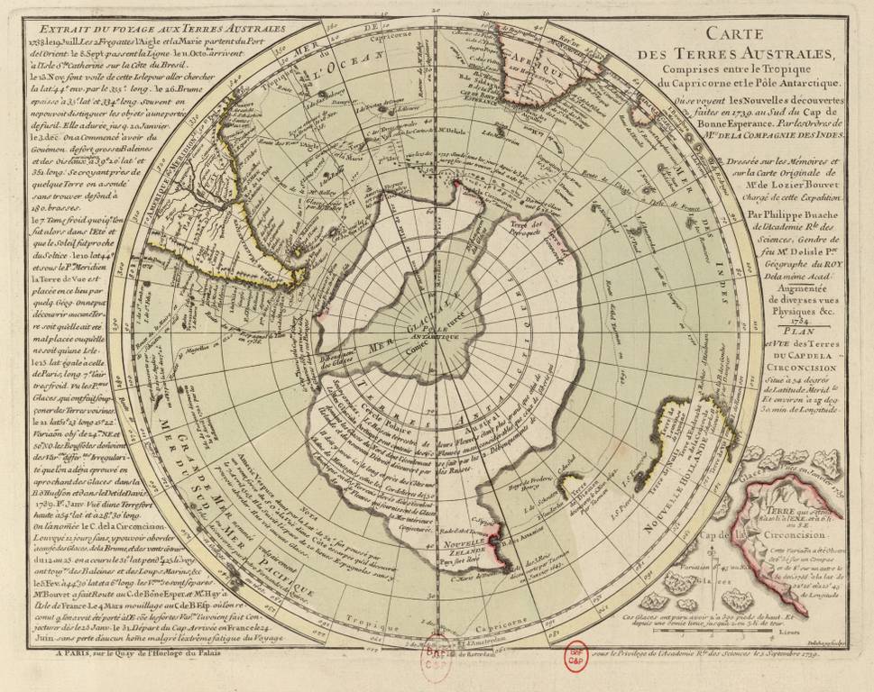
Antarctica, like an alluring and at the same time repulsive forbidden fruit, slowly and gradually allowed sailors to approach it. Dirk Geeritz reaches 64° S in 1559. sh., James Cook in 1773 – 67°5′ S. w. Finding himself lost among icebergs near Tierra del Fuego, the English navigator declares that no Southern continent exists.
For almost half a century, Cook's skepticism discouraged the search for a sixth continent. But in 1820, Bellingshausen and Lazarev managed to reach 69°21′ S. w. – now the much-cherished land is within cannon-shot distance. Only the Norwegian expedition of Karsten Borchgrevink in 1895 made the first recorded landing on the Southern Continent.
According to the Antarctic Treaty, signed in 1959, only 7 states lay claim to certain sectors of the continent - Great Britain, Norway, France, Chile, Argentina, Australia and New Zealand. But everyone’s territorial appetites are different.
If France claims a narrow strip of land - Adélie Land, occupying 432,000 km², then Australia is counting on almost half the area of Antarctica. At the same time, Chile, New Zealand, Great Britain and Argentina dispute almost the same territory.
Each country is trying to look to the future of the Southern continent. The British, for example, seriously intend to develop the Antarctic shelf, which is rich in hydrocarbons. It is possible that Antarctica may be populated in the near future. Already today, due to global warming, tundra is beginning to form on the land areas farthest from the pole, and in 100 years scientists predict the appearance of trees here.
Throughout the history of mankind, numerous geographical discoveries have occurred, but only those that were made at the end of the 15th - first half of the 16th centuries were called Great. Indeed, never again before or after this historical moment discoveries of such magnitude and of such enormous significance for humanity have never been made. European navigators discovered entire continents and oceans, vast unexplored lands inhabited by peoples completely unfamiliar to them. The discoveries of that time amazed the imagination and revealed completely new prospects for development to the European world, which previously could not even be dreamed of.
Prerequisites for the Great Geographical Discoveries
The sailors of that era had not only a great goal, but also the means to achieve it. Progress in navigation led to the appearance in the 15th century. a new type of vessel capable of long ocean voyages. It was a caravel - a fast, maneuverable ship, the sailing equipment of which allowed it to move even in a headwind. At the same time, instruments appeared that made it possible to navigate long sea voyages, primarily the astrolabe - a tool for determining geographic coordinates, latitude and longitude. European cartographers learned to make special navigation maps that made it easier to plot courses across the ocean.

The goal of the Europeans was India, which appeared to their imagination as a country with incalculable riches. India has been known in Europe since ancient times, and goods brought from there have always been in great demand. However, there were no direct connections with her. Trade was carried out through numerous intermediaries, and states located on the routes to India prevented the development of its contacts with Europe. The Turkish conquests of the late Middle Ages led to a sharp decline in trade, which was very profitable for European merchants. The countries of the East were superior to the West in terms of wealth and level of economic development at that time, so trade with them was the most profitable type entrepreneurial activity in Europe.
After the Crusades, as a result of which the European population became familiar with the values of everyday oriental culture, his needs for luxury goods, other household goods and spices increased. Pepper, for example, was then literally worth its weight in gold. The need for gold itself also increased sharply, as the development of trade was accompanied by a rapid expansion of money circulation. All this prompted the search for new trade routes to the East, bypassing Turkish and Arab possessions. India became a magical symbol that inspired brave sailors.
Swimming of Vasco da Gama
The Portuguese were the first to embark on the path of great discoveries. Portugal, before other states of the Iberian Peninsula, completed the Reconquista and transferred the fight against the Moors to the territory North Africa. Throughout the 15th century. Portuguese sailors in search of gold, ivory and other exotic goods moved far south along the African coast. The inspiration for these voyages was Prince Enrique, who received the honorary nickname “The Navigator” for this.
In 1488, Bartolomeu Dias discovered the southern tip of Africa, called the Cape of Good Hope. After that historical discovery The Portuguese took a direct route across the Indian Ocean to the wonderland that beckoned them.
In 1497-1499. The squadron under the command of Vasco da Gama (1469-1524) made the first voyage to India and back, thus paving the most important trade route to the East, which was a long-standing dream of European sailors. In the Indian port of Calicut, the Portuguese purchased so many spices that the income from their sale was 60 times higher than the cost of organizing the expedition.

The sea route to India was discovered and charted, allowing Western European sailors to regularly make these extremely profitable voyages.
Discoveries of Christopher Columbus
Meanwhile, Spain joined the discovery process. In 1492, her troops crushed the Emirate of Granada - the last Moorish state in Europe. The triumphant completion of the Reconquista made it possible to direct the foreign policy power and energy of the Spanish state to new grandiose achievements.
The problem was that Portugal achieved recognition of its exclusive rights to the lands and sea routes discovered by its sailors. A way out of the situation was offered by advanced science of the time. The Italian scientist Paolo Toscanelli, convinced of the sphericity of the Earth, proved that you can reach India if you sail from Europe not to the east, but in the opposite direction - to the west.
Another Italian, a sailor from Genoa, Cristobal Colon, who went down in history under the Spanish name Christopher Columbus (1451-1506), developed on this basis a project for an expedition to find a western route to India. He managed to achieve his approval by the Spanish royal couple - King Ferdinand and Queen Isabella.

X. Columbus

After a multi-day voyage, on October 12, 1492, his ships reached about. San Salvador, located near the coast of America. This day is considered the date of the discovery of America, although Columbus himself was convinced that he had reached the shores of India. That is why the inhabitants of the lands he discovered began to be called Indians.

Before 1504, Columbus made three more voyages, during which he made new discoveries in the basin Caribbean Sea.
Since the descriptions of the two “Indies” discovered by the Portuguese and the Spaniards differed sharply from each other, the names East (Eastern) and West (Western) Indies were assigned to them. Gradually the Europeans came to realize that it was not easy different countries, but even different continents. At the suggestion of Amerigo Vespucci, the lands discovered in the Western Hemisphere began to be called the New World, and soon the new part of the world was named after the insightful Italian. The name West Indies was assigned only to the islands located between the shores of North and South America. The East Indies began to be called not only India itself, but also other countries of Southeast Asia, including Japan.
Discovery of the Pacific Ocean and the first circumnavigation of the world
America, which at first did not bring big income the Spanish crown, was seen as an annoying obstacle on the way to rich India, which stimulated further searches. Of utmost importance was the discovery of a new ocean on the other side of America.
In 1513, the Spanish conqueror Vasco Nunez de Balboa crossed the Isthmus of Panama and reached the shores of a sea unknown to Europeans, which was first called the South Sea (in contrast to the Caribbean Sea, located north of the Isthmus of Panama). Subsequently it turned out that this is an entire ocean, which we now know as the Pacific. This is what Ferdinand Magellan (1480-1521), the organizer of the first circumnavigation in history, called it.

F. Magellan
A Portuguese navigator who entered Spanish service, he was convinced that if he circumnavigated America from the south, it would be possible to reach India by the western sea route. In 1519, his ships set sail, and the next year, having crossed the strait named after the leader of the expedition, they entered the vastness of the Pacific Ocean. Magellan himself died in a clash with the population of one of the islands, later called the Philippine Islands. During the voyage, most of his crew also died, but 18 of the 265 crew members, led by captain H.-S. El Cano, on the only surviving ship, completed the first voyage around the world in 1522, thus proving the existence of a single World Ocean connecting all the continents of the Earth.
The discoveries of sailors in Portugal and Spain gave rise to the problem of delimiting the possessions of these powers. In 1494, the two countries signed a spanish city The Treaty of Tordesillas, according to which a demarcation line was drawn across the Atlantic Ocean, from the North Pole to the South Pole. All newly discovered lands to the east of it were declared the possession of Portugal, to the west - of Spain.
35 years later he was imprisoned new agreement, delimiting the possessions of the two powers in the Pacific Ocean. This is how the first division of the world took place.
“The existence of such a path can be proven based on the spherical shape of the Earth.” It is necessary to “start sailing continuously to the west”, “in order to reach places where all kinds of spices and gems. Do not be surprised that I call the country where spices grow west, while they are usually called east, because people who constantly sail to the west reach these countries by sailing on the other side of the globe.”
“The Latins should seek this country not only because great treasures, gold, silver and all kinds of precious stones and spices can be obtained from there, but also for the sake of its learned people, philosophers and skilled astrologers, and also in order to find out how how such a vast and populous country is governed and how they conduct their wars.”
References:
V.V. Noskov, T.P. Andreevskaya / History from the end of the 15th to the end of the 18th century